San Nicolás (La Burrera) geodata
San Nicolás (La Burrera) (Veracruz) is a populated place; located in Mexico in America/Mexico_City (GMT-6) time zone. With population of 534 people, there are 15868 cities with bigger population in this country. Compared to other cities in Mexico, 73.3% of cities are located further ↑North; 81.7% of cities are located further ←West and 89% of cities have higher elevation than San Nicolás (La Burrera). Note1
Current local time in San Nicolás (La Burrera):
06:49 AM, WednesdayDifference from your time zone: hours


San Nicolás (La Burrera) GPS coordinates[2]
18° 26' 12.012" North, 96° 8' 30.984" West
| Map corner | latitude | longitude |
|---|---|---|
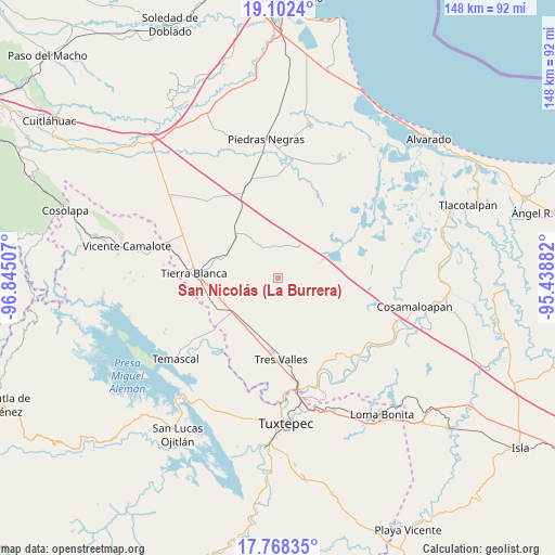
| Upper-left | 19.1024°, | -96.84507° |
| Center: | 18.43667°, | -96.14194° |
| Lower-right: | 17.76835°, | -95.43882° |
| Map W x H: | 148.3×148.3 km | = 92.1×92.1mi |
| max Lat: | 32.7° ⇑73.3% North |
| San Nicolás (La Burrera): | 18.43667° |
| min Lat: | ⇓26.7% South 14.53588° |
| min Long | San Nicolás (L | max Long |
| -117.105° | -96.14194° | -86.73105° |
| W 81.7%⇐ | ⇒18.3% E |
Elevation
Elevation of San Nicolás (La Burrera) is 27 m = 89 ft, and this is 1226.7 m = 4025 ft below average elevation for this country.
| Max E: |
3497 m = 11473 ft | 89% |
| Avg. | 1253.7 m = 4113 ft | |
| San Nicolás (La Burrera) | 27 m = 89 ft | |
Min E: |
-1 m = -3 ft | 11% |
See also: Mexico elevation on elevation.city.
Geographical zone
San Nicolás (La Burrera) is located in North Torrid zone (between Equator and Tropic of Cancer). Distance of this Northern Tropic circle is 556 km =345.5 mi to North.| Distance of | km | miles | from San Nicolás (La Burrera) |
|---|---|---|---|
| North Pole | 7957.1 | 4944.3 | to North |
| Arctic Circle | 5351.2 | 3325.1 | to North |
| Tropic Cancer | 556 | 345.5 | to North |
| Equator | 2050 | 1273.8 | to South |


Nearby cities:
15 places around San Nicolás (La Burrera): (largest is in red/bold)
• Barahúnda
9.7 km =6 mi,  32°
32°
• Colonia Adolfo Ruiz Cortines (Colonia Obrera)
20.1 km =12.5 mi,  185°
185°
• El Jícaro
16.6 km =10.3 mi,  316°
316°
• El Moral
15.2 km =9.4 mi,  16°
16°
• Ideal de Arriba
4.3 km =2.7 mi,  93°
93°
• La Atalaya
17.7 km =11 mi,  256°
256°
• La Granja
15.3 km =9.5 mi,  233°
233°
• La Isla
18.2 km =11.3 mi,  357°
357°
• La Victoria
19.3 km =12 mi,  277°
277°
• Las Yaguas
15.6 km =9.7 mi,  215°
215°
• Los Naranjos
9.5 km =5.9 mi,  195°
195°
• Nuevo San José Independencia
10 km =6.2 mi,  121°
121°
• Poblado Cinco (Nuevo Villa Ojitlán)
8.2 km =5.1 mi, 92°
• Poblado Dos
17 km =10.6 mi,  140°
140°
• Poblado Tres
17.2 km =10.7 mi,  161°
161°
Sources, notices
• [Note1] Compared only with cities in Mexico existing in our database
• [Src1] Map data: © OpenStreetMap contributors (CC-BY-SA)
• [Src2] Other city data from geonames.org with taken over terms of usage.
• [Src3] Geographical zone / Annual Mean Temperature by Robert A. Rohde @ Wikipedia
