Laja del Tubo geodata
Laja del Tubo (Veracruz) is a populated place; located in Mexico in America/Mexico_City (GMT-6) time zone. With population of 533 people, there are 15888 cities with bigger population in this country. Compared to other cities in Mexico, 72.8% of cities are located further ↓South; 70.7% of cities are located further ←West and 85.3% of cities have higher elevation than Laja del Tubo. Note1


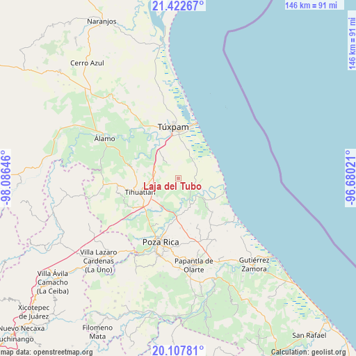
Laja del Tubo GPS coordinates[2]
20° 46' 0.012" North, 97° 22' 59.988" West
| Map corner | latitude | longitude |
|---|---|---|
| Upper-left | 21.42267°, | -98.08646° |
| Center: | 20.76667°, | -97.38333° |
| Lower-right: | 20.10781°, | -96.68021° |
| Map W x H: | 146.2×146.2 km | = 90.8×90.8mi |
| max Lat: | 32.7° ⇑27.2% North |
| Laja del Tubo: | 20.76667° |
| min Lat: | ⇓72.8% South 14.53588° |
| min Long | Laja del Tubo | max Long |
| -117.105° | -97.38333° | -86.73105° |
| W 70.7%⇐ | ⇒29.3% E |
Elevation
Elevation of Laja del Tubo is 42 m = 138 ft, and this is 1211.7 m = 3975 ft below average elevation for this country.
| Max E: |
3497 m = 11473 ft | 85.3% |
| Avg. | 1253.7 m = 4113 ft | |
| Laja del Tubo | 42 m = 138 ft | |
Min E: |
-1 m = -3 ft | 14.7% |
See also: Mexico elevation on elevation.city.
Geographical zone
Laja del Tubo is located in North Torrid zone (between Equator and Tropic of Cancer). Distance of this Northern Tropic circle is 296.9 km =184.5 mi to North.| Distance of | km | miles | from Laja del Tubo |
|---|---|---|---|
| North Pole | 7698 | 4783.3 | to North |
| Arctic Circle | 5092.1 | 3164.1 | to North |
| Tropic Cancer | 296.9 | 184.5 | to North |
| Equator | 2309 | 1434.7 | to South |


Nearby cities:
15 places around Laja del Tubo: (largest is in red/bold)
• Acontitla
9.4 km =5.8 mi,  180°
180°
• Aire Libre
8.9 km =5.5 mi,  51°
51°
• Barrio Acosta Lagunes
10.7 km =6.6 mi,  138°
138°
• Cabellal Número Uno
11.8 km =7.3 mi,  148°
148°
• Cazones de Herrera
10.3 km =6.4 mi,  132°
132°
• Cañada Rica
11.6 km =7.2 mi,  303°
303°
• Chichimantla Segundo
11.3 km =7 mi,  231°
231°
• El Salto de la Reforma
2.8 km =1.7 mi,  17°
17°
• El Sauce
5.8 km =3.6 mi, 139°
• La Ceiba
11.2 km =7 mi,  87°
87°
• La Piedad
10.9 km =6.8 mi,  162°
162°
• Manlio Fabio Altamirano
6.8 km =4.2 mi,  108°
108°
• Nuevo Tejamanil
4.9 km =3 mi,  191°
191°
• Peña de Afuera
7.8 km =4.8 mi,  13°
13°
• Praxedis Guerrero (Kilómetro 18)
8.2 km =5.1 mi,  63°
63°
Sources, notices
• [Note1] Compared only with cities in Mexico existing in our database
• [Src1] Map data: © OpenStreetMap contributors (CC-BY-SA)
• [Src2] Other city data from geonames.org with taken over terms of usage.
• [Src3] Geographical zone / Annual Mean Temperature by Robert A. Rohde @ Wikipedia
