Oyamecalco el Cajón geodata
Oyamecalco el Cajón (Puebla) is a populated place; located in Mexico in America/Mexico_City (GMT-6) time zone. With population of 513 people, there are 16399 cities with bigger population in this country. Compared to other cities in Mexico, 62.9% of cities are located further ↑North; 71.4% of cities are located further ←West and 100% of cities have lower elevation than Oyamecalco el Cajón. Note1


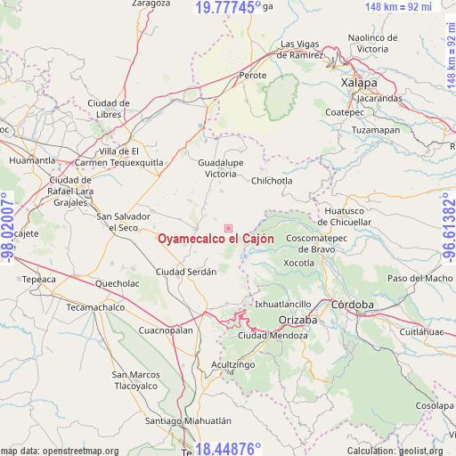
Oyamecalco el Cajón GPS coordinates[2]
19° 6' 51.984" North, 97° 19' 0.984" West
| Map corner | latitude | longitude |
|---|---|---|
| Upper-left | 19.77745°, | -98.02007° |
| Center: | 19.11444°, | -97.31694° |
| Lower-right: | 18.44876°, | -96.61382° |
| Map W x H: | 147.7×147.7 km | = 91.8×91.8mi |
| max Lat: | 32.7° ⇑62.9% North |
| Oyamecalco el Cajón: | 19.11444° |
| min Lat: | ⇓37.1% South 14.53588° |
| min Long | Oyamecalco el C | max Long |
| -117.105° | -97.31694° | -86.73105° |
| W 71.4%⇐ | ⇒28.6% E |
Elevation
Elevation of Oyamecalco el Cajón is 3158 m = 10361 ft, and this is 1904.3 m = 6248 ft above average elevation for this country.
| Max E: |
3497 m = 11473 ft | 0% |
| Oyamecalco el Cajón | 3158 m 10361 ft | |
| Avg. | 1253.7 m = 4113 ft | |
Min E: |
-1 m = -3 ft | 100% |
See also: Mexico elevation on elevation.city.
Geographical zone
Oyamecalco el Cajón is located in North Torrid zone (between Equator and Tropic of Cancer). Distance of this Northern Tropic circle is 480.6 km =298.6 mi to North.| Distance of | km | miles | from Oyamecalco el Cajón |
|---|---|---|---|
| North Pole | 7881.7 | 4897.5 | to North |
| Arctic Circle | 5275.8 | 3278.2 | to North |
| Tropic Cancer | 480.6 | 298.6 | to North |
| Equator | 2125.3 | 1320.6 | to South |


Nearby cities:
15 places around Oyamecalco el Cajón: (largest is in red/bold)
• Cuauhtémoc
12.3 km =7.6 mi,  349°
349°
• Emancipación Quetzalapa
10.3 km =6.4 mi,  309°
309°
• Guadalupe Libertad
11 km =6.8 mi,  317°
317°
• Lázaro Cárdenas
9.3 km =5.8 mi,  289°
289°
• Manuel Edgardo Ávalos (San Isidro)
9.4 km =5.8 mi,  236°
236°
• Nueva Vaquería
11.3 km =7 mi,  101°
101°
• Paso Nacional
5.4 km =3.4 mi, 307°
• Rafael Avila Camacho
10.2 km =6.3 mi,  277°
277°
• San Francisco Independencia (Santa María Aserradero)
12.9 km =8 mi,  246°
246°
• San José Llano Grande
7.9 km =4.9 mi,  209°
209°
• San Martín Ojo de Agua
13.8 km =8.6 mi, 214°
• San Miguel Zoapan
5.1 km =3.2 mi,  228°
228°
• Santa Inés Varela la Luz
8.8 km =5.5 mi,  300°
300°
• Santa María el Aserradero (Peones Acasillados)
8.6 km =5.3 mi, 235°
• Tlachichuca
10.7 km =6.6 mi,  270°
270°
Sources, notices
• [Note1] Compared only with cities in Mexico existing in our database
• [Src1] Map data: © OpenStreetMap contributors (CC-BY-SA)
• [Src2] Other city data from geonames.org with taken over terms of usage.
• [Src3] Geographical zone / Annual Mean Temperature by Robert A. Rohde @ Wikipedia
