La Curva Tlaltzintla geodata
La Curva Tlaltzintla (Hidalgo) is a populated place; located in Mexico in America/Mexico_City (GMT-6) time zone. With population of 510 people, there are 16480 cities with bigger population in this country. Compared to other cities in Mexico, 78.3% of cities are located further ↓South; 57.9% of cities are located further ←West and 75.5% of cities have higher elevation than La Curva Tlaltzintla. Note1
Current local time in La Curva Tlaltzintla:
08:30 AM, WednesdayDifference from your time zone: hours


La Curva Tlaltzintla GPS coordinates[2]
21° 7' 44.004" North, 98° 27' 10.008" West
| Map corner | latitude | longitude |
|---|---|---|
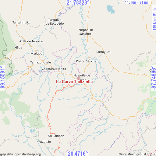
| Upper-left | 21.78328°, | -99.15591° |
| Center: | 21.12889°, | -98.45278° |
| Lower-right: | 20.4716°, | -97.74966° |
| Map W x H: | 145.8×145.8 km | = 90.6×90.6mi |
| max Lat: | 32.7° ⇑21.7% North |
| La Curva Tlaltzintla: | 21.12889° |
| min Lat: | ⇓78.3% South 14.53588° |
| min Long | La Curva Tlaltz | max Long |
| -117.105° | -98.45278° | -86.73105° |
| W 57.9%⇐ | ⇒42.1% E |
Elevation
Elevation of La Curva Tlaltzintla is 204 m = 669 ft, and this is 1049.7 m = 3444 ft below average elevation for this country.
| Max E: |
3497 m = 11473 ft | 75.5% |
| Avg. | 1253.7 m = 4113 ft | |
| La Curva Tlaltzintla | 204 m = 669 ft | |
Min E: |
-1 m = -3 ft | 24.5% |
See also: Mexico elevation on elevation.city.
Geographical zone
La Curva Tlaltzintla is located in North Torrid zone (between Equator and Tropic of Cancer). Distance of this Northern Tropic circle is 256.6 km =159.4 mi to North.| Distance of | km | miles | from La Curva Tlaltzintla |
|---|---|---|---|
| North Pole | 7657.7 | 4758.3 | to North |
| Arctic Circle | 5051.9 | 3139.1 | to North |
| Tropic Cancer | 256.6 | 159.4 | to North |
| Equator | 2349.3 | 1459.8 | to South |


Nearby cities:
15 places around La Curva Tlaltzintla: (largest is in red/bold)
• Acoapa
3.7 km =2.3 mi,  256°
256°
• Aguacatitla
1.8 km =1.1 mi,  164°
164°
• Aquixcuatitla
3 km =1.9 mi,  221°
221°
• Atalco
4.4 km =2.7 mi,  165°
165°
• Chililico
1.9 km =1.2 mi,  70°
70°
• Coamila
5.1 km =3.2 mi,  245°
245°
• Contepec
4 km =2.5 mi,  279°
279°
• Huejutla de Reyes
3.7 km =2.3 mi, 70°
• Hueynali
2.1 km =1.3 mi,  350°
350°
• Macustepetla
3 km =1.9 mi, 257°
• Panacaxtlán
2.2 km =1.4 mi, 353°
• Tepexititla
0.7 km =0.4 mi,  58°
58°
• Xocotitla
3.8 km =2.4 mi,  266°
266°
• Zapotitla
0.8 km =0.5 mi, 68°
• Zitlán
5.1 km =3.2 mi,  322°
322°
Sources, notices
• [Note1] Compared only with cities in Mexico existing in our database
• [Src1] Map data: © OpenStreetMap contributors (CC-BY-SA)
• [Src2] Other city data from geonames.org with taken over terms of usage.
• [Src3] Geographical zone / Annual Mean Temperature by Robert A. Rohde @ Wikipedia
