Huejutla de Reyes geodata
Huejutla de Reyes (Hidalgo) is a populated place; located in Mexico in America/Mexico_City (GMT-6) time zone. With population of 40,015 people, there are 263 cities with bigger population in this country. Compared to other cities in Mexico, 78.4% of cities are located further ↓South; 58.4% of cities are located further ←West and 77.1% of cities have higher elevation than Huejutla de Reyes. Note1


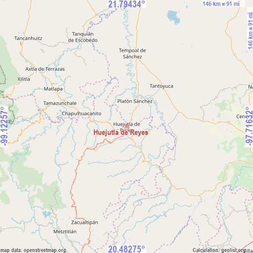
Huejutla de Reyes GPS coordinates[2]
21° 8' 24" North, 98° 25' 9.984" West
| Map corner | latitude | longitude |
|---|---|---|
| Upper-left | 21.79434°, | -99.12257° |
| Center: | 21.14°, | -98.41944° |
| Lower-right: | 20.48275°, | -97.71632° |
| Map W x H: | 145.8×145.8 km | = 90.6×90.6mi |
| max Lat: | 32.7° ⇑21.6% North |
| Huejutla de Reyes: | 21.14° |
| min Lat: | ⇓78.4% South 14.53588° |
| min Long | Huejutla de Rey | max Long |
| -117.105° | -98.41944° | -86.73105° |
| W 58.4%⇐ | ⇒41.6% E |
Elevation
Elevation of Huejutla de Reyes is 152 m = 499 ft, and this is 1101.7 m = 3615 ft below average elevation for this country.
| Max E: |
3497 m = 11473 ft | 77.1% |
| Avg. | 1253.7 m = 4113 ft | |
| Huejutla de Reyes | 152 m = 499 ft | |
Min E: |
-1 m = -3 ft | 22.9% |
See also: Huejutla de Reyes elevation on elevation.city.
Geographical zone
Huejutla de Reyes is located in North Torrid zone (between Equator and Tropic of Cancer). Distance of this Northern Tropic circle is 255.4 km =158.7 mi to North.| Distance of | km | miles | from Huejutla de Reyes |
|---|---|---|---|
| North Pole | 7656.5 | 4757.5 | to North |
| Arctic Circle | 5050.6 | 3138.3 | to North |
| Tropic Cancer | 255.4 | 158.7 | to North |
| Equator | 2350.5 | 1460.5 | to South |


Nearby cities:
15 places around Huejutla de Reyes: (largest is in red/bold)
• Aguacatitla
4.2 km =2.6 mi,  224°
224°
• Ahuatempa
5.9 km =3.7 mi,  140°
140°
• Chalahuiyapa
5.8 km =3.6 mi,  78°
78°
• Chililico
1.8 km =1.1 mi,  249°
249°
• Corral Blanco (Todos por Hidalgo)
3.6 km =2.2 mi,  65°
65°
• El Pintor
2.3 km =1.4 mi,  17°
17°
• Hueynali
3.9 km =2.4 mi,  282°
282°
• La Curva Tlaltzintla
3.7 km =2.3 mi, 250°
• Las Pilas
2.6 km =1.6 mi,  37°
37°
• Panacaxtlán
3.8 km =2.4 mi, 284°
• Parque de Poblamiento Solidaridad
3.7 km =2.3 mi, 68°
• Santa Catarina
6 km =3.7 mi, 137°
• Tancazahuela
5 km =3.1 mi,  341°
341°
• Tepexititla
3 km =1.9 mi, 253°
• Zapotitla
2.8 km =1.7 mi, 250°
Sources, notices
• [Note1] Compared only with cities in Mexico existing in our database
• [Src1] Map data: © OpenStreetMap contributors (CC-BY-SA)
• [Src2] Other city data from geonames.org with taken over terms of usage.
• [Src3] Geographical zone / Annual Mean Temperature by Robert A. Rohde @ Wikipedia
