Tlamoloaxtla geodata
Tlamoloaxtla (Puebla) is a populated place; located in Mexico in America/Mexico_City (GMT-6) time zone. With population of 505 people, there are 16660 cities with bigger population in this country. Compared to other cities in Mexico, 59.1% of cities are located further ↑North; 73.8% of cities are located further ←West and 52% of cities have higher elevation than Tlamoloaxtla. Note1


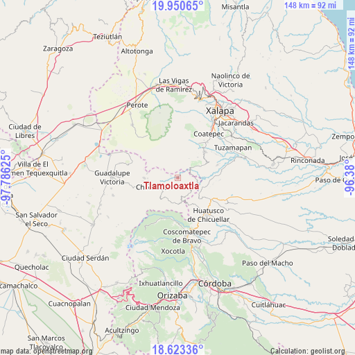
Tlamoloaxtla GPS coordinates[2]
19° 17' 18.06" North, 97° 4' 59.232" West
| Map corner | latitude | longitude |
|---|---|---|
| Upper-left | 19.95065°, | -97.78625° |
| Center: | 19.28835°, | -97.08312° |
| Lower-right: | 18.62336°, | -96.38° |
| Map W x H: | 147.6×147.6 km | = 91.7×91.7mi |
| max Lat: | 32.7° ⇑59.1% North |
| Tlamoloaxtla: | 19.28835° |
| min Lat: | ⇓40.9% South 14.53588° |
| min Long | Tlamoloaxtla | max Long |
| -117.105° | -97.08312° | -86.73105° |
| W 73.8%⇐ | ⇒26.2% E |
Elevation
Elevation of Tlamoloaxtla is 1341 m = 4400 ft, and this is 87.3 m = 286 ft above average elevation for this country.
| Max E: |
3497 m = 11473 ft | 52% |
| Tlamoloaxtla | 1341 m 4400 ft | |
| Avg. | 1253.7 m = 4113 ft | |
Min E: |
-1 m = -3 ft | 48% |
See also: Mexico elevation on elevation.city.
Geographical zone
Tlamoloaxtla is located in North Torrid zone (between Equator and Tropic of Cancer). Distance of this Northern Tropic circle is 461.3 km =286.6 mi to North.| Distance of | km | miles | from Tlamoloaxtla |
|---|---|---|---|
| North Pole | 7862.4 | 4885.5 | to North |
| Arctic Circle | 5256.5 | 3266.2 | to North |
| Tropic Cancer | 461.3 | 286.6 | to North |
| Equator | 2144.7 | 1332.7 | to South |


Nearby cities:
15 places around Tlamoloaxtla: (largest is in red/bold)
• Ahuacapan
5.7 km =3.5 mi,  260°
260°
• Barranca Nueva
7.2 km =4.5 mi,  40°
40°
• Buenavista
3.5 km =2.2 mi,  166°
166°
• Casa Quemada
8.5 km =5.3 mi,  55°
55°
• Cinco de Mayo
5.2 km =3.2 mi, 170°
• Colonia la Concepción
4.5 km =2.8 mi,  189°
189°
• El Rosario
7.2 km =4.5 mi, 173°
• El Triunfo
8 km =5 mi,  142°
142°
• Huaxcaleca
6.1 km =3.8 mi, 173°
• Ixhuacán de los Reyes
8.3 km =5.2 mi,  334°
334°
• San Isidro Reynosa
3.7 km =2.3 mi,  156°
156°
• San Martín Comalapa
8.9 km =5.5 mi,  102°
102°
• Tlamanca
3.3 km =2.1 mi,  281°
281°
• Tozihuic
4.4 km =2.7 mi,  199°
199°
• Villa Hermosa (San José)
3.3 km =2.1 mi, 174°
Sources, notices
• [Note1] Compared only with cities in Mexico existing in our database
• [Src1] Map data: © OpenStreetMap contributors (CC-BY-SA)
• [Src2] Other city data from geonames.org with taken over terms of usage.
• [Src3] Geographical zone / Annual Mean Temperature by Robert A. Rohde @ Wikipedia
