San Isidro Reynosa geodata
San Isidro Reynosa (Puebla) is a populated place; located in Mexico in America/Mexico_City (GMT-6) time zone. With population of 561 people, there are 15205 cities with bigger population in this country. Compared to other cities in Mexico, 59.7% of cities are located further ↑North; 74% of cities are located further ←West and 77.2% of cities have lower elevation than San Isidro Reynosa. Note1


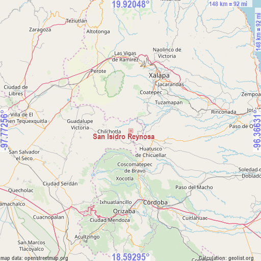
San Isidro Reynosa GPS coordinates[2]
19° 15' 29.016" North, 97° 4' 9.948" West
| Map corner | latitude | longitude |
|---|---|---|
| Upper-left | 19.92048°, | -97.77256° |
| Center: | 19.25806°, | -97.06943° |
| Lower-right: | 18.59295°, | -96.36631° |
| Map W x H: | 147.6×147.6 km | = 91.7×91.7mi |
| max Lat: | 32.7° ⇑59.7% North |
| San Isidro Reynosa: | 19.25806° |
| min Lat: | ⇓40.3% South 14.53588° |
| min Long | San Isidro Reyn | max Long |
| -117.105° | -97.06943° | -86.73105° |
| W 74%⇐ | ⇒26% E |
Elevation
Elevation of San Isidro Reynosa is 2072 m = 6798 ft, and this is 818.3 m = 2685 ft above average elevation for this country.
| Max E: |
3497 m = 11473 ft | 22.8% |
| San Isidro Reynosa | 2072 m 6798 ft | |
| Avg. | 1253.7 m = 4113 ft | |
Min E: |
-1 m = -3 ft | 77.2% |
See also: Mexico elevation on elevation.city.
Geographical zone
San Isidro Reynosa is located in North Torrid zone (between Equator and Tropic of Cancer). Distance of this Northern Tropic circle is 464.6 km =288.7 mi to North.| Distance of | km | miles | from San Isidro Reynosa |
|---|---|---|---|
| North Pole | 7865.8 | 4887.6 | to North |
| Arctic Circle | 5259.9 | 3268.3 | to North |
| Tropic Cancer | 464.6 | 288.7 | to North |
| Equator | 2141.3 | 1330.5 | to South |


Nearby cities:
15 places around San Isidro Reynosa: (largest is in red/bold)
• Buenavista
0.6 km =0.4 mi,  265°
265°
• Chichiquila
6.4 km =4 mi,  177°
177°
• Cinco de Mayo
1.8 km =1.1 mi,  199°
199°
• Colonia la Concepción
2.4 km =1.5 mi,  244°
244°
• El Rosario
3.9 km =2.4 mi,  190°
190°
• El Triunfo
4.5 km =2.8 mi,  130°
130°
• Huaxcaleca
2.8 km =1.7 mi, 196°
• Ojo de Agua
7.5 km =4.7 mi,  219°
219°
• San Martín Comalapa
7.4 km =4.6 mi,  78°
78°
• Tlamanca
6.1 km =3.8 mi,  311°
311°
• Tlamoloaxtla
3.7 km =2.3 mi,  336°
336°
• Tozihuic
3 km =1.9 mi,  255°
255°
• Villa Hermosa (San José)
1.1 km =0.7 mi,  276°
276°
• Xochimilco
6.8 km =4.2 mi,  212°
212°
• Xopanapa
7.4 km =4.6 mi, 214°
Sources, notices
• [Note1] Compared only with cities in Mexico existing in our database
• [Src1] Map data: © OpenStreetMap contributors (CC-BY-SA)
• [Src2] Other city data from geonames.org with taken over terms of usage.
• [Src3] Geographical zone / Annual Mean Temperature by Robert A. Rohde @ Wikipedia
