Nuevo Conhuás geodata
Nuevo Conhuás (Campeche) is a populated place; located in Mexico in America/Merida (GMT-6) time zone. With population of 503 people, there are 16722 cities with bigger population in this country. Compared to other cities in Mexico, 72.1% of cities are located further ↑North; 97.6% of cities are located further ←West and 76.8% of cities have higher elevation than Nuevo Conhuás. Note1


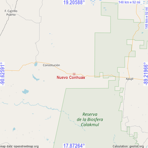
Nuevo Conhuás GPS coordinates[2]
18° 32' 26.016" North, 89° 55' 22.008" West
| Map corner | latitude | longitude |
|---|---|---|
| Upper-left | 19.20588°, | -90.62591° |
| Center: | 18.54056°, | -89.92278° |
| Lower-right: | 17.87264°, | -89.21966° |
| Map W x H: | 148.2×148.2 km | = 92.1×92.1mi |
| max Lat: | 32.7° ⇑72.1% North |
| Nuevo Conhuás: | 18.54056° |
| min Lat: | ⇓27.9% South 14.53588° |
| min Long | Nuevo Conhuás | max Long |
| -117.105° | -89.92278° | -86.73105° |
| W 97.6%⇐ | ⇒2.4% E |
Elevation
Elevation of Nuevo Conhuás is 158 m = 518 ft, and this is 1095.7 m = 3595 ft below average elevation for this country.
| Max E: |
3497 m = 11473 ft | 76.8% |
| Avg. | 1253.7 m = 4113 ft | |
| Nuevo Conhuás | 158 m = 518 ft | |
Min E: |
-1 m = -3 ft | 23.2% |
See also: Mexico elevation on elevation.city.
Geographical zone
Nuevo Conhuás is located in North Torrid zone (between Equator and Tropic of Cancer). Distance of this Northern Tropic circle is 544.4 km =338.3 mi to North.| Distance of | km | miles | from Nuevo Conhuás |
|---|---|---|---|
| North Pole | 7945.5 | 4937.1 | to North |
| Arctic Circle | 5339.7 | 3317.9 | to North |
| Tropic Cancer | 544.4 | 338.3 | to North |
| Equator | 2061.5 | 1281 | to South |


Nearby cities:
15 places around Nuevo Conhuás: (largest is in red/bold)
• Altamira de Zináparo
35.4 km =22 mi,  277°
277°
• Centenario
40.1 km =24.9 mi,  287°
287°
• Chan Laguna
30.9 km =19.2 mi,  257°
257°
• Constitución
24.4 km =15.2 mi, 293°
• El Lechugal
53.3 km =33.1 mi, 277°
• Ingeniero Ricardo Payro Jene (Polo Norte)
56 km =34.8 mi,  116°
116°
• Justicia Social
49.7 km =30.9 mi, 280°
• La Libertad
62.4 km =38.8 mi,  273°
273°
• Laguna Grande
49.6 km =30.8 mi,  308°
308°
• Manuel Castilla Brito
54.6 km =33.9 mi,  111°
111°
• Pablo García
24.5 km =15.2 mi, 290°
• Silvituc
38.4 km =23.9 mi, 286°
• Xbonil
27.8 km =17.3 mi, 292°
• Xpujil
55.8 km =34.7 mi,  93°
93°
• Zoh-Laguna
53.6 km =33.3 mi,  83°
83°
Sources, notices
• [Note1] Compared only with cities in Mexico existing in our database
• [Src1] Map data: © OpenStreetMap contributors (CC-BY-SA)
• [Src2] Other city data from geonames.org with taken over terms of usage.
• [Src3] Geographical zone / Annual Mean Temperature by Robert A. Rohde @ Wikipedia
