Manuel Castilla Brito geodata
Manuel Castilla Brito (Campeche) is a populated place; located in Mexico in America/Merida (GMT-6) time zone. With population of 516 people, there are 16314 cities with bigger population in this country. Compared to other cities in Mexico, 74.2% of cities are located further ↑North; 98.2% of cities are located further ←West and 74.2% of cities have higher elevation than Manuel Castilla Brito. Note1
Current local time in Manuel Castilla Brito:
08:28 AM, WednesdayDifference from your time zone: hours


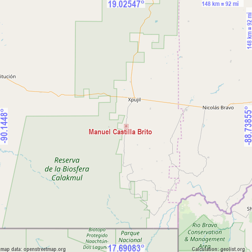
Manuel Castilla Brito GPS coordinates[2]
18° 21' 33.984" North, 89° 26' 30.012" West
| Map corner | latitude | longitude |
|---|---|---|
| Upper-left | 19.02547°, | -90.1448° |
| Center: | 18.35944°, | -89.44167° |
| Lower-right: | 17.69083°, | -88.73855° |
| Map W x H: | 148.4×148.4 km | = 92.2×92.2mi |
| max Lat: | 32.7° ⇑74.2% North |
| Manuel Castilla Brito: | 18.35944° |
| min Lat: | ⇓25.8% South 14.53588° |
| min Long | Manuel Castilla | max Long |
| -117.105° | -89.44167° | -86.73105° |
| W 98.2%⇐ | ⇒1.8% E |
Elevation
Elevation of Manuel Castilla Brito is 247 m = 810 ft, and this is 1006.7 m = 3303 ft below average elevation for this country.
| Max E: |
3497 m = 11473 ft | 74.2% |
| Avg. | 1253.7 m = 4113 ft | |
| Manuel Castilla Brito | 247 m = 810 ft | |
Min E: |
-1 m = -3 ft | 25.8% |
See also: Mexico elevation on elevation.city.
Geographical zone
Manuel Castilla Brito is located in North Torrid zone (between Equator and Tropic of Cancer). Distance of this Northern Tropic circle is 564.5 km =350.8 mi to North.| Distance of | km | miles | from Manuel Castilla Brito |
|---|---|---|---|
| North Pole | 7965.7 | 4949.7 | to North |
| Arctic Circle | 5359.8 | 3330.4 | to North |
| Tropic Cancer | 564.5 | 350.8 | to North |
| Equator | 2041.4 | 1268.5 | to South |


Nearby cities:
15 places around Manuel Castilla Brito: (largest is in red/bold)
• Caobas
36.8 km =22.9 mi,  75°
75°
• Francisco Villa
64.4 km =40 mi, 78°
• Ingeniero Ricardo Payro Jene (Polo Norte)
4.7 km =2.9 mi,  186°
186°
• Lázaro Cárdenas Segundo
72.3 km =44.9 mi,  58°
58°
• Miguel Alemán
71.7 km =44.6 mi,  30°
30°
• Morocoy
71.8 km =44.6 mi,  67°
67°
• Nachi Cocom
74.1 km =46 mi, 79°
• Nicolás Bravo
55.3 km =34.4 mi, 78°
• Nuevo Becar
52.2 km =32.4 mi,  38°
38°
• Nuevo Conhuás
54.6 km =33.9 mi,  291°
291°
• San Pedro Peralta
72.5 km =45 mi, 58°
• Santo Domingo
40.6 km =25.2 mi,  170°
170°
• Tres Garantías
51.9 km =32.2 mi,  110°
110°
• Xpujil
17.2 km =10.7 mi,  16°
16°
• Zoh-Laguna
26.1 km =16.2 mi,  5°
5°
Sources, notices
• [Note1] Compared only with cities in Mexico existing in our database
• [Src1] Map data: © OpenStreetMap contributors (CC-BY-SA)
• [Src2] Other city data from geonames.org with taken over terms of usage.
• [Src3] Geographical zone / Annual Mean Temperature by Robert A. Rohde @ Wikipedia
