San Nicolás de los Ranchos geodata
San Nicolás de los Ranchos (Puebla) is a seat of a second-order administrative division; located in Mexico in America/Mexico_City (GMT-6) time zone. With population of 5,685 people, there are 1638 cities with bigger population in this country. Compared to other cities in Mexico, 63.5% of cities are located further ↑North; 57.4% of cities are located further ←West and 91.2% of cities have lower elevation than San Nicolás de los Ranchos. Note1
Current local time in San Nicolás de los Ranchos:
05:10 PM, TuesdayDifference from your time zone: hours


San Nicolás de los Ranchos GPS coordinates[2]
19° 4' 17.004" North, 98° 29' 9.636" West
| Map corner | latitude | longitude |
|---|---|---|
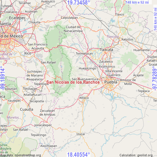
| Upper-left | 19.73458°, | -99.18914° |
| Center: | 19.07139°, | -98.48601° |
| Lower-right: | 18.40554°, | -97.78289° |
| Map W x H: | 147.8×147.8 km | = 91.8×91.8mi |
| max Lat: | 32.7° ⇑63.5% North |
| San Nicolás de los Ranchos: | 19.07139° |
| min Lat: | ⇓36.5% South 14.53588° |
| min Long | San Nicolás de | max Long |
| -117.105° | -98.48601° | -86.73105° |
| W 57.4%⇐ | ⇒42.6% E |
Elevation
Elevation of San Nicolás de los Ranchos is 2448 m = 8031 ft, and this is 1194.3 m = 3918 ft above average elevation for this country.
| Max E: |
3497 m = 11473 ft | 8.8% |
| San Nicolás de los Ranchos | 2448 m 8031 ft | |
| Avg. | 1253.7 m = 4113 ft | |
Min E: |
-1 m = -3 ft | 91.2% |
See also: Mexico elevation on elevation.city.
Geographical zone
San Nicolás de los Ranchos is located in North Torrid zone (between Equator and Tropic of Cancer). Distance of this Northern Tropic circle is 485.4 km =301.6 mi to North.| Distance of | km | miles | from San Nicolás de los Ranchos |
|---|---|---|---|
| North Pole | 7886.5 | 4900.4 | to North |
| Arctic Circle | 5280.6 | 3281.2 | to North |
| Tropic Cancer | 485.4 | 301.6 | to North |
| Equator | 2120.5 | 1317.6 | to South |


Nearby cities:
15 places around San Nicolás de los Ranchos: (largest is in red/bold)
• Cháhuac
8.5 km =5.3 mi,  48°
48°
• Domingo Arenas
8.2 km =5.1 mi,  21°
21°
• Nealtican
6.6 km =4.1 mi,  111°
111°
• Pueblo Nuevo
6.3 km =3.9 mi, 51°
• San Andrés Calpan
4.4 km =2.7 mi,  35°
35°
• San Baltazar Atlimeyaya
9.4 km =5.8 mi,  176°
176°
• San Diego Buenavista
6.7 km =4.2 mi,  5°
5°
• San Juan Pancoac
9.8 km =6.1 mi,  28°
28°
• San Lucas Atzala
3.6 km =2.2 mi, 6°
• San Mateo Ozolco
4.4 km =2.7 mi,  315°
315°
• San Miguel Papaxtla
10.1 km =6.3 mi,  95°
95°
• San Pedro Yancuitlalpan
0.7 km =0.4 mi, 22°
• Santa María Atexcac
7.3 km =4.5 mi,  351°
351°
• Santa María Nepopualco
8.9 km =5.5 mi,  356°
356°
• Xalitzintla
3.4 km =2.1 mi,  289°
289°
Sources, notices
• [Note1] Compared only with cities in Mexico existing in our database
• [Src1] Map data: © OpenStreetMap contributors (CC-BY-SA)
• [Src2] Other city data from geonames.org with taken over terms of usage.
• [Src3] Geographical zone / Annual Mean Temperature by Robert A. Rohde @ Wikipedia
