Tapah Road geodata
Tapah Road (Perak) is a populated place; located in Malaysia in Asia/Kuala_Lumpur (GMT+8) time zone. With population of 27,863 people, there are 94 cities with bigger population in this country. Compared to other cities in Malaysia, 52.2% of cities are located further ↓South; 74.2% of cities are located further →East and 79.8% of cities have lower elevation than Tapah Road. Note1


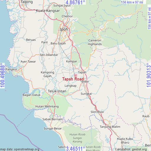
Tapah Road GPS coordinates[2]
4° 10' 0.012" North, 101° 12' 0" East
| Map corner | latitude | longitude |
|---|---|---|
| Upper-left | 4.86761°, | 100.49688° |
| Center: | 4.16667°, | 101.2° |
| Lower-right: | 3.46511°, | 101.90313° |
| Map W x H: | 155.9×155.9 km | = 96.9×96.9mi |
| max Lat: | 6.88732° ⇑47.8% North |
| Tapah Road: | 4.16667° |
| min Lat: | ⇓52.2% South 1.24722° |
| min Long | Tapah Road | max Long |
| 99.68252° | 101.2° | 118.61119° |
| W 25.8%⇐ | ⇒74.2% E |
Elevation
Elevation of Tapah Road is 40 m = 131 ft, and this is 4.7 m = 15 ft below average elevation for this country.
| Max E: |
1488 m = 4882 ft | 20.2% |
| Avg. | 44.7 m = 147 ft | |
| Tapah Road | 40 m = 131 ft | |
Min E: |
0 m = 0 ft | 79.8% |
See also: Malaysia elevation on elevation.city.
Geographical zone
Tapah Road is located in North Torrid zone (between Equator and Tropic of Cancer). Distance of Equator is 463.3 km =287.9 mi to South.| Distance of | km | miles | from Tapah Road |
|---|---|---|---|
| North Pole | 9543.8 | 5930.2 | to North |
| Arctic Circle | 6937.9 | 4311 | to North |
| Tropic Cancer | 2142.6 | 1331.3 | to North |
| Equator | 463.3 | 287.9 | to South |


Nearby cities:
15 places around Tapah Road: (largest is in red/bold)
• Batang Berjuntai
90.4 km =56.2 mi,  164°
164°
• Batu Gajah
38 km =23.6 mi,  332°
332°
• Bidur
10.8 km =6.7 mi,  121°
121°
• Ipoh
48.2 km =30 mi,  344°
344°
• Kampar
15.8 km =9.8 mi, 339°
• Kampung Tanjung Karang
82.6 km =51.3 mi,  181°
181°
• Kuala Kangsar
73 km =45.4 mi, 336°
• Kuala Selangor
91 km =56.5 mi, 176°
• Lumut
63.6 km =39.5 mi,  276°
276°
• Pantai Remis
71 km =44.1 mi,  296°
296°
• Raub
84.1 km =52.3 mi, 119°
• Sabak Bernam
50 km =31.1 mi,  208°
208°
• Sungai Besar
59.6 km =37 mi,  203°
203°
• Tanah Rata
38.4 km =23.9 mi,  30°
30°
• Teluk Intan
25.6 km =15.9 mi,  231°
231°
Sources, notices
• [Note1] Compared only with cities in Malaysia existing in our database
• [Src1] Map data: © OpenStreetMap contributors (CC-BY-SA)
• [Src2] Other city data from geonames.org with taken over terms of usage.
• [Src3] Geographical zone / Annual Mean Temperature by Robert A. Rohde @ Wikipedia
