Gurun geodata
Gurun (Kedah) is a populated place; located in Malaysia in Asia/Kuala_Lumpur (GMT+8) time zone. With population of 15,964 people, there are 136 cities with bigger population in this country. Compared to other cities in Malaysia, 80.3% of cities are located further ↓South; 85.4% of cities are located further →East and 64% of cities have lower elevation than Gurun. Note1


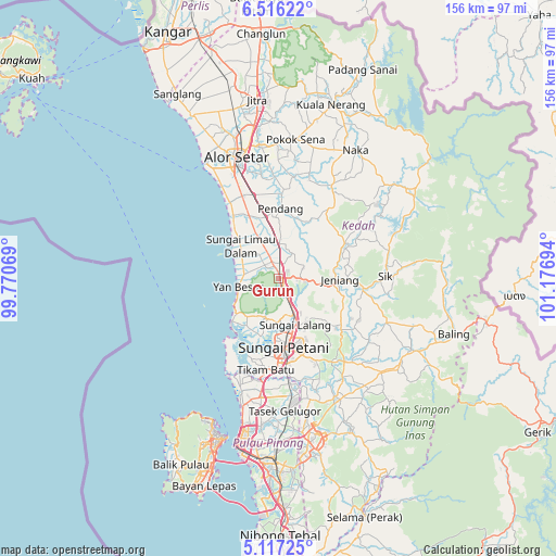
Gurun GPS coordinates[2]
5° 49' 1.812" North, 100° 28' 25.716" East
| Map corner | latitude | longitude |
|---|---|---|
| Upper-left | 6.51622°, | 99.77069° |
| Center: | 5.81717°, | 100.47381° |
| Lower-right: | 5.11725°, | 101.17694° |
| Map W x H: | 155.6×155.6 km | = 96.7×96.7mi |
| max Lat: | 6.88732° ⇑19.7% North |
| Gurun: | 5.81717° |
| min Lat: | ⇓80.3% South 1.24722° |
| min Long | Gurun | max Long |
| 99.68252° | 100.47381° | 118.61119° |
| W 14.6%⇐ | ⇒85.4% E |
Elevation
Elevation of Gurun is 22 m = 72 ft, and this is 22.7 m = 74 ft below average elevation for this country.
| Max E: |
1488 m = 4882 ft | 36% |
| Avg. | 44.7 m = 147 ft | |
| Gurun | 22 m = 72 ft | |
Min E: |
0 m = 0 ft | 64% |
See also: Malaysia elevation on elevation.city.
Geographical zone
Gurun is located in North Torrid zone (between Equator and Tropic of Cancer). Distance of Equator is 646.8 km =401.9 mi to South.| Distance of | km | miles | from Gurun |
|---|---|---|---|
| North Pole | 9360.3 | 5816.2 | to North |
| Arctic Circle | 6754.4 | 4197 | to North |
| Tropic Cancer | 1959.1 | 1217.3 | to North |
| Equator | 646.8 | 401.9 | to South |


Nearby cities:
15 places around Gurun: (largest is in red/bold)
• Alor Setar
36 km =22.4 mi,  339°
339°
• Batu Feringgi
46.1 km =28.6 mi,  213°
213°
• Bedong
10.7 km =6.6 mi,  158°
158°
• Bukit Mertajam
50.5 km =31.4 mi,  180°
180°
• Butterworth
48.1 km =29.9 mi,  194°
194°
• George Town
47.7 km =29.6 mi,  198°
198°
• Kampung Batu Feringgi
46.2 km =28.7 mi, 213°
• Kepala Batas
33.8 km =21 mi, 188°
• Kuala Kedah
36.9 km =22.9 mi,  328°
328°
• Perai
49.3 km =30.6 mi, 191°
• Permatang Kuching
40.6 km =25.2 mi, 194°
• Sungai Petani
19 km =11.8 mi, 175°
• Tanjung Tokong
43.7 km =27.2 mi, 204°
• Tasek Glugor
37.6 km =23.4 mi, 175°
• Telaga Batu
47.2 km =29.3 mi, 214°
Sources, notices
• [Note1] Compared only with cities in Malaysia existing in our database
• [Src1] Map data: © OpenStreetMap contributors (CC-BY-SA)
• [Src2] Other city data from geonames.org with taken over terms of usage.
• [Src3] Geographical zone / Annual Mean Temperature by Robert A. Rohde @ Wikipedia
