Sungai Pelek New Village geodata
Sungai Pelek New Village (Selangor) is a populated place; located in Malaysia in Asia/Kuala_Lumpur (GMT+8) time zone. With population of 13,829 people, there are 145 cities with bigger population in this country. Compared to other cities in Malaysia, 75.3% of cities are located further ↑North; 60.7% of cities are located further →East and 56.2% of cities have higher elevation than Sungai Pelek New Village. Note1
Current local time in Sungai Pelek New Village:
05:43 PM, MondayDifference from your time zone: hours


Sungai Pelek New Village GPS coordinates[2]
2° 39' 0" North, 101° 42' 0" East
| Map corner | latitude | longitude |
|---|---|---|
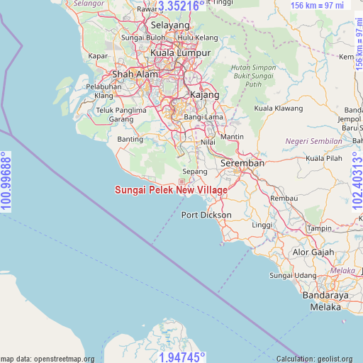
| Upper-left | 3.35216°, | 100.99688° |
| Center: | 2.65°, | 101.7° |
| Lower-right: | 1.94745°, | 102.40313° |
| Map W x H: | 156.2×156.2 km | = 97.1×97.1mi |
| max Lat: | 6.88732° ⇑75.3% North |
| Sungai Pelek New Village: | 2.65° |
| min Lat: | ⇓24.7% South 1.24722° |
| min Long | Sungai Pelek Ne | max Long |
| 99.68252° | 101.7° | 118.61119° |
| W 39.3%⇐ | ⇒60.7% E |
Elevation
Elevation of Sungai Pelek New Village is 12 m = 39 ft, and this is 32.7 m = 107 ft below average elevation for this country.
| Max E: |
1488 m = 4882 ft | 56.2% |
| Avg. | 44.7 m = 147 ft | |
| Sungai Pelek New Village | 12 m = 39 ft | |
Min E: |
0 m = 0 ft | 43.8% |
See also: Malaysia elevation on elevation.city.
Geographical zone
Sungai Pelek New Village is located in North Torrid zone (between Equator and Tropic of Cancer). Distance of Equator is 294.7 km =183.1 mi to South.| Distance of | km | miles | from Sungai Pelek New Village |
|---|---|---|---|
| North Pole | 9712.4 | 6035 | to North |
| Arctic Circle | 7106.5 | 4415.8 | to North |
| Tropic Cancer | 2311.3 | 1436.2 | to North |
| Equator | 294.7 | 183.1 | to South |


Nearby cities:
15 places around Sungai Pelek New Village: (largest is in red/bold)
• Banting
28.6 km =17.8 mi,  309°
309°
• Jenjarum
33.6 km =20.9 mi,  317°
317°
• Kampong Baharu Balakong
43 km =26.7 mi,  7°
7°
• Kampung Baharu Nilai
20.2 km =12.6 mi,  32°
32°
• Klang
51.6 km =32.1 mi,  326°
326°
• Kuala Sungai Baru
49.3 km =30.6 mi,  130°
130°
• Pelabuhan Klang
51.7 km =32.1 mi, 318°
• Port Dickson
17.2 km =10.7 mi,  136°
136°
• Putra Heights
40.7 km =25.3 mi,  339°
339°
• Putrajaya
31.7 km =19.7 mi,  358°
358°
• Semenyih
37.1 km =23.1 mi, 25°
• Sepang
7.3 km =4.5 mi,  49°
49°
• Seremban
27.9 km =17.3 mi,  71°
71°
• Subang Jaya
45.8 km =28.5 mi, 343°
• Tanjung Sepat
15.3 km =9.5 mi,  273°
273°
Sources, notices
• [Note1] Compared only with cities in Malaysia existing in our database
• [Src1] Map data: © OpenStreetMap contributors (CC-BY-SA)
• [Src2] Other city data from geonames.org with taken over terms of usage.
• [Src3] Geographical zone / Annual Mean Temperature by Robert A. Rohde @ Wikipedia
