Bagani geodata
Bagani (Zambezi) is a populated place; located in Namibia in Africa/Windhoek (GMT+2) time zone. With population of 2,000 people, there are 41 cities with bigger population in this country. Compared to other cities in Namibia, 72.7% of cities are located further ↓South; 97.7% of cities are located further ←West and 68.2% of cities have higher elevation than Bagani. Note1


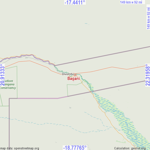
Bagani GPS coordinates[2]
18° 6' 38.34" South, 21° 36' 59.22" East
| Map corner | latitude | longitude |
|---|---|---|
| Upper-left | -17.4411°, | 20.91333° |
| Center: | -18.11065°, | 21.61645° |
| Lower-right: | -18.77765°, | 22.31958° |
| Map W x H: | 148.6×148.6 km | = 92.3×92.3mi |
| max Lat: | -17.4° ⇑27.3% North |
| Bagani: | -18.11065° |
| min Lat: | ⇓72.7% South -28.55° |
| min Long | Bagani | max Long |
| 13.83998° | 21.61645° | 24.26667° |
| W 97.7%⇐ | ⇒2.3% E |
Elevation
Elevation of Bagani is 1007 m = 3304 ft, and this is 20.8 m = 68 ft below average elevation for this country.
| Max E: |
1656 m = 5433 ft | 68.2% |
| Avg. | 1027.8 m = 3372 ft | |
| Bagani | 1007 m = 3304 ft | |
Min E: |
1 m = 3 ft | 31.8% |
See also: Namibia elevation on elevation.city.
Geographical zone
Bagani is located in South Torrid zone (between Equator and Tropic of Capricorn). Distance of this Southern Tropic circle is 592.2 km =368 mi to South.| Distance of | km | miles | from Bagani |
|---|---|---|---|
| Equator | 2013.7 | 1251.3 | to North |
| Tropic Capricorn | 592.2 | 368 | to South |
| Antarctic Circle | 5387.5 | 3347.6 | to South |
| South Pole | 7993.3 | 4966.8 | to South |


Nearby cities:
4 places around Bagani: (largest is in red/bold)
• Grootfontein
402.3 km =250 mi,  246°
246°
• Katima Mulilo
288.7 km =179.4 mi,  76°
76°
• Nkurenkuru
323.9 km =201.3 mi,  279°
279°
• Rundu
196.6 km =122.2 mi, 275°
Sources, notices
• [Note1] Compared only with cities in Namibia existing in our database
• [Src1] Map data: © OpenStreetMap contributors (CC-BY-SA)
• [Src2] Other city data from geonames.org with taken over terms of usage.
• [Src3] Geographical zone / Annual Mean Temperature by Robert A. Rohde @ Wikipedia
