Nkurenkuru geodata
Nkurenkuru (Kavango West) is a seat of a first-order administrative division; located in Namibia in Africa/Windhoek (GMT+2) time zone. In our database, there are 43 cities with bigger population. Compared to other cities in Namibia, 90.9% of cities are located further ↓South; 84.1% of cities are located further ←West and 61.4% of cities have higher elevation than Nkurenkuru. Note1


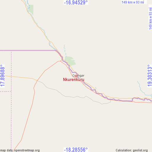
Nkurenkuru GPS coordinates[2]
17° 37' 0.012" South, 18° 36' 0" East
| Map corner | latitude | longitude |
|---|---|---|
| Upper-left | -16.94529°, | 17.89688° |
| Center: | -17.61667°, | 18.6° |
| Lower-right: | -18.28556°, | 19.30313° |
| Map W x H: | 149×149 km | = 92.6×92.6mi |
| max Lat: | -17.4° ⇑9.1% North |
| Nkurenkuru: | -17.61667° |
| min Lat: | ⇓90.9% South -28.55° |
| min Long | Nkurenkuru | max Long |
| 13.83998° | 18.6° | 24.26667° |
| W 84.1%⇐ | ⇒15.9% E |
Elevation
Elevation of Nkurenkuru is 1098 m = 3602 ft, and this is 70.2 m = 230 ft above average elevation for this country.
| Max E: |
1656 m = 5433 ft | 61.4% |
| Nkurenkuru | 1098 m 3602 ft | |
| Avg. | 1027.8 m = 3372 ft | |
Min E: |
1 m = 3 ft | 38.6% |
See also: Namibia elevation on elevation.city.
Geographical zone
Nkurenkuru is located in South Torrid zone (between Equator and Tropic of Capricorn). Distance of this Southern Tropic circle is 647.1 km =402.1 mi to South.| Distance of | km | miles | from Nkurenkuru |
|---|---|---|---|
| Equator | 1958.8 | 1217.1 | to North |
| Tropic Capricorn | 647.1 | 402.1 | to South |
| Antarctic Circle | 5442.4 | 3381.7 | to South |
| South Pole | 8048.3 | 5001 | to South |


Nearby cities:
15 places around Nkurenkuru: (largest is in red/bold)
• Bagani
323.9 km =201.3 mi,  99°
99°
• Eenhana
240.9 km =149.7 mi,  273°
273°
• Grootfontein
222.7 km =138.4 mi,  193°
193°
• Okahao
375.4 km =233.3 mi, 265°
• Okakarara
351.9 km =218.7 mi,  200°
200°
• Omuthiya
229.1 km =142.4 mi,  248°
248°
• Ondangwa
282.6 km =175.6 mi,  263°
263°
• Ongandjera
375.3 km =233.2 mi, 265°
• Ongwediva
300.7 km =186.8 mi, 266°
• Oshakati
307.3 km =190.9 mi, 266°
• Oshikango
289.1 km =179.6 mi, 274°
• Otavi
262.5 km =163.1 mi,  210°
210°
• Otjiwarongo
377.2 km =234.4 mi, 212°
• Rundu
128.4 km =79.8 mi,  105°
105°
• Tsumeb
202.5 km =125.8 mi, 207°
Sources, notices
• [Note1] Compared only with cities in Namibia existing in our database
• [Src1] Map data: © OpenStreetMap contributors (CC-BY-SA)
• [Src2] Other city data from geonames.org with taken over terms of usage.
• [Src3] Geographical zone / Annual Mean Temperature by Robert A. Rohde @ Wikipedia
