Miringa geodata
Miringa (Borno) is a populated place; located in Nigeria in Africa/Lagos (GMT+1) time zone. With population of 12,117 people, there are 294 cities with bigger population in this country. Compared to other cities in Nigeria, 70.6% of cities are located further ↓South; 94.6% of cities are located further ←West and 95.1% of cities have lower elevation than Miringa. Note1


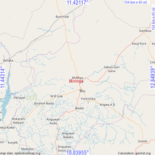
Miringa GPS coordinates[2]
10° 43' 52.14" North, 12° 8' 46.536" East
| Map corner | latitude | longitude |
|---|---|---|
| Upper-left | 11.42117°, | 11.44314° |
| Center: | 10.73115°, | 12.14626° |
| Lower-right: | 10.03955°, | 12.84939° |
| Map W x H: | 153.6×153.6 km | = 95.4×95.4mi |
| max Lat: | 13.7543° ⇑29.4% North |
| Miringa: | 10.73115° |
| min Lat: | ⇓70.6% South 4.31231° |
| min Long | Miringa | max Long |
| 2.73333° | 12.14626° | 14.46552° |
| W 94.6%⇐ | ⇒5.4% E |
Elevation
Elevation of Miringa is 659 m = 2162 ft, and this is 362.5 m = 1189 ft above average elevation for this country.
| Max E: |
1599 m = 5246 ft | 4.9% |
| Miringa | 659 m 2162 ft | |
| Avg. | 296.5 m = 973 ft | |
Min E: |
2 m = 7 ft | 95.1% |
See also: Nigeria elevation on elevation.city.
Geographical zone
Miringa is located in North Torrid zone (between Equator and Tropic of Cancer). Distance of Equator is 1193.2 km =741.4 mi to South.| Distance of | km | miles | from Miringa |
|---|---|---|---|
| North Pole | 8813.9 | 5476.7 | to North |
| Arctic Circle | 6208 | 3857.5 | to North |
| Tropic Cancer | 1412.7 | 877.8 | to North |
| Equator | 1193.2 | 741.4 | to South |


Nearby cities:
15 places around Miringa: (largest is in red/bold)
• Askira
83.8 km =52.1 mi,  96°
96°
• Azare
27.8 km =17.3 mi,  145°
145°
• Bajoga
79.2 km =49.2 mi,  279°
279°
• Bara
55.5 km =34.5 mi,  294°
294°
• Biu
14.2 km =8.8 mi,  158°
158°
• Briyel
72.5 km =45 mi,  233°
233°
• Buni Yadi
62.2 km =38.6 mi,  346°
346°
• Chibok
78 km =48.5 mi,  78°
78°
• Damboa
81.6 km =50.7 mi,  54°
54°
• Goniri
85.7 km =53.3 mi,  12°
12°
• Hinna
85.2 km =52.9 mi,  236°
236°
• Kwaya Kusar
41.7 km =25.9 mi, 232°
• Shaffa
32.2 km =20 mi,  140°
140°
• Shani
57.8 km =35.9 mi,  189°
189°
• Wuyo
62.4 km =38.8 mi, 231°
Sources, notices
• [Note1] Compared only with cities in Nigeria existing in our database
• [Src1] Map data: © OpenStreetMap contributors (CC-BY-SA)
• [Src2] Other city data from geonames.org with taken over terms of usage.
• [Src3] Geographical zone / Annual Mean Temperature by Robert A. Rohde @ Wikipedia
