Kabba geodata
Kabba (Kogi) is a seat of a second-order administrative division; located in Nigeria in Africa/Lagos (GMT+1) time zone. With population of 49,869 people, there are 147 cities with bigger population in this country. Compared to other cities in Nigeria, 55.6% of cities are located further ↑North; 69.7% of cities are located further →East and 75.6% of cities have lower elevation than Kabba. Note1


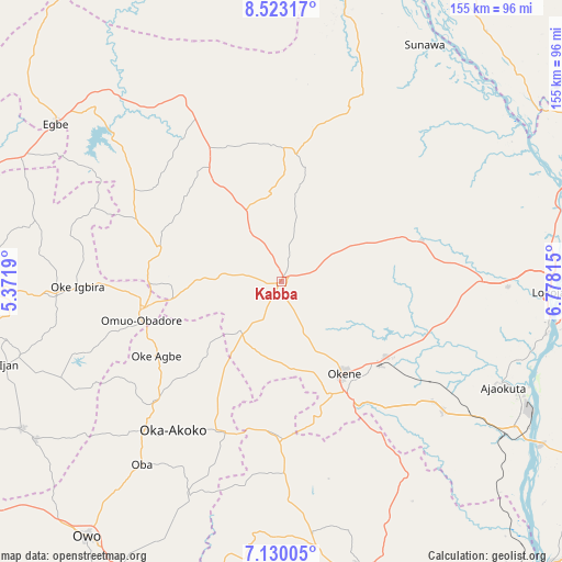
Kabba GPS coordinates[2]
7° 49' 37.884" North, 6° 4' 30.072" East
| Map corner | latitude | longitude |
|---|---|---|
| Upper-left | 8.52317°, | 5.3719° |
| Center: | 7.82719°, | 6.07502° |
| Lower-right: | 7.13005°, | 6.77815° |
| Map W x H: | 154.9×154.9 km | = 96.3×96.3mi |
| max Lat: | 13.7543° ⇑55.6% North |
| Kabba: | 7.82719° |
| min Lat: | ⇓44.4% South 4.31231° |
| min Long | Kabba | max Long |
| 2.73333° | 6.07502° | 14.46552° |
| W 30.3%⇐ | ⇒69.7% E |
Elevation
Elevation of Kabba is 436 m = 1430 ft, and this is 139.5 m = 458 ft above average elevation for this country.
| Max E: |
1599 m = 5246 ft | 24.4% |
| Kabba | 436 m 1430 ft | |
| Avg. | 296.5 m = 973 ft | |
Min E: |
2 m = 7 ft | 75.6% |
See also: Kabba elevation on elevation.city.
Geographical zone
Kabba is located in North Torrid zone (between Equator and Tropic of Cancer). Distance of Equator is 870.3 km =540.8 mi to South.| Distance of | km | miles | from Kabba |
|---|---|---|---|
| North Pole | 9136.8 | 5677.3 | to North |
| Arctic Circle | 6530.9 | 4058.1 | to North |
| Tropic Cancer | 1735.6 | 1078.5 | to North |
| Equator | 870.3 | 540.8 | to South |


Nearby cities:
15 places around Kabba: (largest is in red/bold)
• Adogo
56.9 km =35.4 mi,  128°
128°
• Akpafa
40.4 km =25.1 mi,  168°
168°
• Ikare
48.8 km =30.3 mi,  226°
226°
• Isanlu
58.5 km =36.4 mi,  331°
331°
• Isanlu-Itedoijowa
56.3 km =35 mi, 332°
• Isua
45.3 km =28.1 mi,  203°
203°
• Iyara
11.6 km =7.2 mi,  278°
278°
• Mopa
36.7 km =22.8 mi, 326°
• Obangede
26.7 km =16.6 mi,  149°
149°
• Ode
40.2 km =25 mi,  264°
264°
• Ogaminana
30.4 km =18.9 mi, 148°
• Oka
50.7 km =31.5 mi,  216°
216°
• Oke-Agbe
40.3 km =25 mi,  239°
239°
• Okene
35.4 km =22 mi, 149°
• Omuo-Ekiti
39.6 km =24.6 mi, 258°
Sources, notices
• [Note1] Compared only with cities in Nigeria existing in our database
• [Src1] Map data: © OpenStreetMap contributors (CC-BY-SA)
• [Src2] Other city data from geonames.org with taken over terms of usage.
• [Src3] Geographical zone / Annual Mean Temperature by Robert A. Rohde @ Wikipedia
