Ogaminana geodata
Ogaminana (Kogi) is a seat of a second-order administrative division; located in Nigeria in Africa/Lagos (GMT+1) time zone. With population of 84,373 people, there are 106 cities with bigger population in this country. Compared to other cities in Nigeria, 59.4% of cities are located further ↑North; 67.8% of cities are located further →East and 55.1% of cities have higher elevation than Ogaminana. Note1


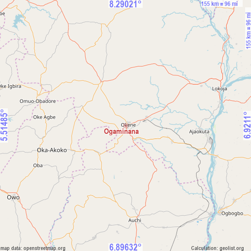
Ogaminana GPS coordinates[2]
7° 35' 37.788" North, 6° 13' 4.728" East
| Map corner | latitude | longitude |
|---|---|---|
| Upper-left | 8.29021°, | 5.51485° |
| Center: | 7.59383°, | 6.21798° |
| Lower-right: | 6.89632°, | 6.9211° |
| Map W x H: | 155×155 km | = 96.3×96.3mi |
| max Lat: | 13.7543° ⇑59.4% North |
| Ogaminana: | 7.59383° |
| min Lat: | ⇓40.6% South 4.31231° |
| min Long | Ogaminana | max Long |
| 2.73333° | 6.21798° | 14.46552° |
| W 32.2%⇐ | ⇒67.8% E |
Elevation
Elevation of Ogaminana is 247 m = 810 ft, and this is 49.5 m = 162 ft below average elevation for this country.
| Max E: |
1599 m = 5246 ft | 55.1% |
| Avg. | 296.5 m = 973 ft | |
| Ogaminana | 247 m = 810 ft | |
Min E: |
2 m = 7 ft | 44.9% |
See also: Ogaminana elevation on elevation.city.
Geographical zone
Ogaminana is located in North Torrid zone (between Equator and Tropic of Cancer). Distance of Equator is 844.4 km =524.7 mi to South.| Distance of | km | miles | from Ogaminana |
|---|---|---|---|
| North Pole | 9162.7 | 5693.4 | to North |
| Arctic Circle | 6556.8 | 4074.2 | to North |
| Tropic Cancer | 1761.6 | 1094.6 | to North |
| Equator | 844.4 | 524.7 | to South |


Nearby cities:
15 places around Ogaminana: (largest is in red/bold)
• Adogo
30.3 km =18.8 mi,  107°
107°
• Ajaokuta
48.3 km =30 mi,  94°
94°
• Akpafa
15.5 km =9.6 mi,  209°
209°
• Auchi
58.7 km =36.5 mi,  175°
175°
• Igarra
35.7 km =22.2 mi,  200°
200°
• Ikare
51.8 km =32.2 mi,  261°
261°
• Isua
37.3 km =23.2 mi,  245°
245°
• Iyara
38.9 km =24.2 mi,  315°
315°
• Kabba
30.4 km =18.9 mi,  328°
328°
• Obangede
3.6 km =2.2 mi, 325°
• Ode
59.9 km =37.2 mi,  291°
291°
• Oka
48.2 km =30 mi, 252°
• Oke-Agbe
50.8 km =31.6 mi,  276°
276°
• Okene
5.1 km =3.2 mi,  157°
157°
• Omuo-Ekiti
57.6 km =35.8 mi, 288°
Sources, notices
• [Note1] Compared only with cities in Nigeria existing in our database
• [Src1] Map data: © OpenStreetMap contributors (CC-BY-SA)
• [Src2] Other city data from geonames.org with taken over terms of usage.
• [Src3] Geographical zone / Annual Mean Temperature by Robert A. Rohde @ Wikipedia
