San Lorenzo geodata
San Lorenzo (Boaco) is a seat of a second-order administrative division; located in Nicaragua in America/Managua (GMT-6) time zone. With population of 8,694 people, there are 47 cities with bigger population in this country. Compared to other cities in Nicaragua, 58.7% of cities are located further ↑North; 71.3% of cities are located further ←West and 59.3% of cities have lower elevation than San Lorenzo. Note1


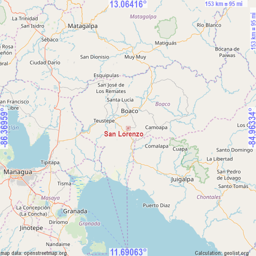
San Lorenzo GPS coordinates[2]
12° 22' 41.88" North, 85° 39' 59.256" West
| Map corner | latitude | longitude |
|---|---|---|
| Upper-left | 13.06416°, | -86.36959° |
| Center: | 12.3783°, | -85.66646° |
| Lower-right: | 11.69063°, | -84.96334° |
| Map W x H: | 152.7×152.7 km | = 94.9×94.9mi |
| max Lat: | 14.74189° ⇑58.7% North |
| San Lorenzo: | 12.3783° |
| min Lat: | ⇓41.3% South 10.94684° |
| min Long | San Lorenzo | max Long |
| -87.4516° | -85.66646° | -83.06145° |
| W 71.3%⇐ | ⇒28.7% E |
Elevation
Elevation of San Lorenzo is 381 m = 1250 ft, and this is 43.8 m = 144 ft above average elevation for this country.
| Max E: |
1288 m = 4226 ft | 40.7% |
| San Lorenzo | 381 m 1250 ft | |
| Avg. | 337.2 m = 1106 ft | |
Min E: |
1 m = 3 ft | 59.3% |
See also: Nicaragua elevation on elevation.city.
Geographical zone
San Lorenzo is located in North Torrid zone (between Equator and Tropic of Cancer). Distance of this Northern Tropic circle is 1229.6 km =764 mi to North.| Distance of | km | miles | from San Lorenzo |
|---|---|---|---|
| North Pole | 8630.7 | 5362.9 | to North |
| Arctic Circle | 6024.8 | 3743.6 | to North |
| Tropic Cancer | 1229.6 | 764 | to North |
| Equator | 1376.3 | 855.2 | to South |


Nearby cities:
15 places around San Lorenzo: (largest is in red/bold)
• Boaco
10.5 km =6.5 mi,  4°
4°
• Camoapa
16.7 km =10.4 mi,  87°
87°
• Comalapa
19.9 km =12.4 mi,  121°
121°
• Cuapa
33.2 km =20.6 mi,  111°
111°
• El Ayote
46.2 km =28.7 mi, 116°
• Esquipulas
34.4 km =21.4 mi,  337°
337°
• Juigalpa
44.6 km =27.7 mi,  132°
132°
• Muy Muy
42.9 km =26.7 mi,  5°
5°
• San Dionisio
46.9 km =29.1 mi,  334°
334°
• San José de los Remates
26.5 km =16.5 mi, 337°
• Santa Lucía
17.8 km =11.1 mi, 344°
• Terrabona
50.8 km =31.6 mi,  320°
320°
• Teustepe
15 km =9.3 mi,  288°
288°
• Tipitapa
50.9 km =31.6 mi,  246°
246°
• Tisma
50.4 km =31.3 mi,  229°
229°
Sources, notices
• [Note1] Compared only with cities in Nicaragua existing in our database
• [Src1] Map data: © OpenStreetMap contributors (CC-BY-SA)
• [Src2] Other city data from geonames.org with taken over terms of usage.
• [Src3] Geographical zone / Annual Mean Temperature by Robert A. Rohde @ Wikipedia
