Puerto Morazán geodata
Puerto Morazán (Chinandega) is a populated place; located in Nicaragua in America/Managua (GMT-6) time zone. With population of 7,671 people, there are 55 cities with bigger population in this country. Compared to other cities in Nicaragua, 61.1% of cities are located further ↓South; 98.2% of cities are located further →East and 97.6% of cities have higher elevation than Puerto Morazán. Note1


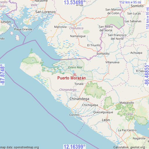
Puerto Morazán GPS coordinates[2]
12° 51' 1.512" North, 87° 10' 18.012" West
| Map corner | latitude | longitude |
|---|---|---|
| Upper-left | 13.53498°, | -87.8748° |
| Center: | 12.85042°, | -87.17167° |
| Lower-right: | 12.16399°, | -86.46855° |
| Map W x H: | 152.4×152.4 km | = 94.7×94.7mi |
| max Lat: | 14.74189° ⇑38.9% North |
| Puerto Morazán: | 12.85042° |
| min Lat: | ⇓61.1% South 10.94684° |
| min Long | Puerto Morazán | max Long |
| -87.4516° | -87.17167° | -83.06145° |
| W 1.8%⇐ | ⇒98.2% E |
Elevation
Elevation of Puerto Morazán is 9 m = 30 ft, and this is 328.2 m = 1077 ft below average elevation for this country.
| Max E: |
1288 m = 4226 ft | 97.6% |
| Avg. | 337.2 m = 1106 ft | |
| Puerto Morazán | 9 m = 30 ft | |
Min E: |
1 m = 3 ft | 2.4% |
See also: Nicaragua elevation on elevation.city.
Geographical zone
Puerto Morazán is located in North Torrid zone (between Equator and Tropic of Cancer). Distance of this Northern Tropic circle is 1177.1 km =731.4 mi to North.| Distance of | km | miles | from Puerto Morazán |
|---|---|---|---|
| North Pole | 8578.2 | 5330.2 | to North |
| Arctic Circle | 5972.3 | 3711 | to North |
| Tropic Cancer | 1177.1 | 731.4 | to North |
| Equator | 1428.8 | 887.8 | to South |


Nearby cities:
15 places around Puerto Morazán: (largest is in red/bold)
• Chichigalpa
34.2 km =21.3 mi,  152°
152°
• Chinandega
25 km =15.5 mi,  169°
169°
• Cinco Pinos
53.5 km =33.2 mi,  37°
37°
• Corinto
40.9 km =25.4 mi,  180°
180°
• El Realejo
34.2 km =21.3 mi, 178°
• El Viejo
20.8 km =12.9 mi, 178°
• Jiquilillo
32.5 km =20.2 mi,  249°
249°
• Posoltega
39.9 km =24.8 mi, 148°
• Quezalguaque
48.1 km =29.9 mi,  142°
142°
• San Francisco
29.8 km =18.5 mi,  264°
264°
• Santo Tomás del Norte
46.1 km =28.6 mi, 35°
• Somotillo
36 km =22.4 mi,  53°
53°
• Telica
49.8 km =30.9 mi, 137°
• Tonalá
10.1 km =6.3 mi,  155°
155°
• Villanueva
40.6 km =25.2 mi,  71°
71°
Sources, notices
• [Note1] Compared only with cities in Nicaragua existing in our database
• [Src1] Map data: © OpenStreetMap contributors (CC-BY-SA)
• [Src2] Other city data from geonames.org with taken over terms of usage.
• [Src3] Geographical zone / Annual Mean Temperature by Robert A. Rohde @ Wikipedia
