Villanueva geodata
Villanueva (Chinandega) is a seat of a second-order administrative division; located in Nicaragua in America/Managua (GMT-6) time zone. In our database, there are 137 cities with bigger population. Compared to other cities in Nicaragua, 66.5% of cities are located further ↓South; 89.8% of cities are located further →East and 85.6% of cities have higher elevation than Villanueva. Note1


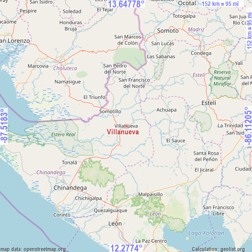
Villanueva GPS coordinates[2]
12° 57' 48.708" North, 86° 48' 54.612" West
| Map corner | latitude | longitude |
|---|---|---|
| Upper-left | 13.64778°, | -87.5183° |
| Center: | 12.96353°, | -86.81517° |
| Lower-right: | 12.2774°, | -86.11205° |
| Map W x H: | 152.4×152.4 km | = 94.7×94.7mi |
| max Lat: | 14.74189° ⇑33.5% North |
| Villanueva: | 12.96353° |
| min Lat: | ⇓66.5% South 10.94684° |
| min Long | Villanueva | max Long |
| -87.4516° | -86.81517° | -83.06145° |
| W 10.2%⇐ | ⇒89.8% E |
Elevation
Elevation of Villanueva is 49 m = 161 ft, and this is 288.2 m = 946 ft below average elevation for this country.
| Max E: |
1288 m = 4226 ft | 85.6% |
| Avg. | 337.2 m = 1106 ft | |
| Villanueva | 49 m = 161 ft | |
Min E: |
1 m = 3 ft | 14.4% |
See also: Nicaragua elevation on elevation.city.
Geographical zone
Villanueva is located in North Torrid zone (between Equator and Tropic of Cancer). Distance of this Northern Tropic circle is 1164.5 km =723.6 mi to North.| Distance of | km | miles | from Villanueva |
|---|---|---|---|
| North Pole | 8565.7 | 5322.5 | to North |
| Arctic Circle | 5959.8 | 3703.2 | to North |
| Tropic Cancer | 1164.5 | 723.6 | to North |
| Equator | 1441.4 | 895.6 | to South |


Nearby cities:
15 places around Villanueva: (largest is in red/bold)
• Achuapa
26.4 km =16.4 mi,  67°
67°
• Chichigalpa
48.7 km =30.3 mi,  208°
208°
• Cinco Pinos
30.1 km =18.7 mi,  349°
349°
• El Sauce
31.1 km =19.3 mi,  105°
105°
• Larreynaga
41.4 km =25.7 mi,  140°
140°
• Las Sabanas
47.1 km =29.3 mi,  26°
26°
• Malpaisillo
43.7 km =27.2 mi,  160°
160°
• Puerto Morazán
40.6 km =25.2 mi,  251°
251°
• San Francisco del Norte
26.6 km =16.5 mi,  10°
10°
• San José de Cusmapa
40.1 km =24.9 mi, 25°
• San Juan de Limay
32.3 km =20.1 mi,  42°
42°
• San Pedro del Norte
35.4 km =22 mi, 348°
• Santo Tomás del Norte
27.3 km =17 mi,  334°
334°
• Somotillo
13.2 km =8.2 mi,  312°
312°
• Tonalá
40.8 km =25.4 mi,  237°
237°
Sources, notices
• [Note1] Compared only with cities in Nicaragua existing in our database
• [Src1] Map data: © OpenStreetMap contributors (CC-BY-SA)
• [Src2] Other city data from geonames.org with taken over terms of usage.
• [Src3] Geographical zone / Annual Mean Temperature by Robert A. Rohde @ Wikipedia
