Quezalguaque geodata
Quezalguaque (León) is a seat of a second-order administrative division; located in Nicaragua in America/Managua (GMT-6) time zone. With population of 1,974 people, there are 111 cities with bigger population in this country. Compared to other cities in Nicaragua, 53.9% of cities are located further ↑North; 92.8% of cities are located further →East and 70.7% of cities have higher elevation than Quezalguaque. Note1


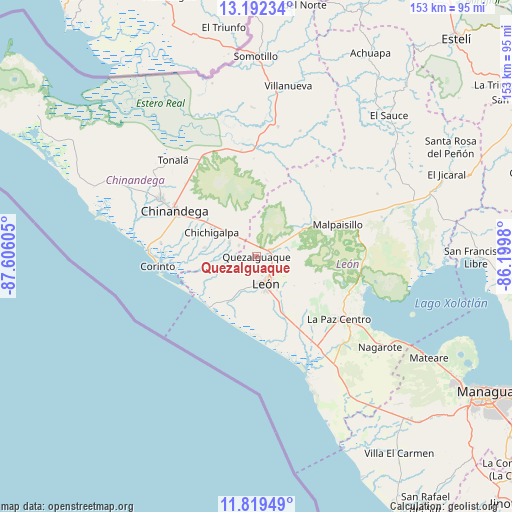
Quezalguaque GPS coordinates[2]
12° 30' 24.588" North, 86° 54' 10.512" West
| Map corner | latitude | longitude |
|---|---|---|
| Upper-left | 13.19234°, | -87.60605° |
| Center: | 12.50683°, | -86.90292° |
| Lower-right: | 11.81949°, | -86.1998° |
| Map W x H: | 152.6×152.6 km | = 94.8×94.8mi |
| max Lat: | 14.74189° ⇑53.9% North |
| Quezalguaque: | 12.50683° |
| min Lat: | ⇓46.1% South 10.94684° |
| min Long | Quezalguaque | max Long |
| -87.4516° | -86.90292° | -83.06145° |
| W 7.2%⇐ | ⇒92.8% E |
Elevation
Elevation of Quezalguaque is 98 m = 322 ft, and this is 239.2 m = 785 ft below average elevation for this country.
| Max E: |
1288 m = 4226 ft | 70.7% |
| Avg. | 337.2 m = 1106 ft | |
| Quezalguaque | 98 m = 322 ft | |
Min E: |
1 m = 3 ft | 29.3% |
See also: Nicaragua elevation on elevation.city.
Geographical zone
Quezalguaque is located in North Torrid zone (between Equator and Tropic of Cancer). Distance of this Northern Tropic circle is 1215.3 km =755.2 mi to North.| Distance of | km | miles | from Quezalguaque |
|---|---|---|---|
| North Pole | 8616.4 | 5354 | to North |
| Arctic Circle | 6010.5 | 3734.8 | to North |
| Tropic Cancer | 1215.3 | 755.2 | to North |
| Equator | 1390.6 | 864.1 | to South |


Nearby cities:
15 places around Quezalguaque: (largest is in red/bold)
• Chichigalpa
15.6 km =9.7 mi,  300°
300°
• Chinandega
28.3 km =17.6 mi, 298°
• Corinto
29.4 km =18.3 mi,  264°
264°
• El Realejo
28.8 km =17.9 mi,  278°
278°
• El Viejo
33.5 km =20.8 mi, 301°
• La Paz Centro
30.9 km =19.2 mi,  126°
126°
• Larreynaga
40.6 km =25.2 mi,  62°
62°
• León
8.1 km =5 mi,  160°
160°
• Malpaisillo
26.1 km =16.2 mi,  68°
68°
• Nagarote
45.5 km =28.3 mi, 126°
• Posoltega
9.3 km =5.8 mi, 296°
• Puerto Morazán
48.1 km =29.9 mi,  322°
322°
• Telica
5 km =3.1 mi, 70°
• Tonalá
38.3 km =23.8 mi, 319°
• Villanueva
51.7 km =32.1 mi,  10°
10°
Sources, notices
• [Note1] Compared only with cities in Nicaragua existing in our database
• [Src1] Map data: © OpenStreetMap contributors (CC-BY-SA)
• [Src2] Other city data from geonames.org with taken over terms of usage.
• [Src3] Geographical zone / Annual Mean Temperature by Robert A. Rohde @ Wikipedia
