La Paz de Carazo geodata
La Paz de Carazo (Carazo) is a seat of a second-order administrative division; located in Nicaragua in America/Managua (GMT-6) time zone. With population of 2,454 people, there are 99 cities with bigger population in this country. Compared to other cities in Nicaragua, 85.6% of cities are located further ↑North; 55.7% of cities are located further →East and 61.1% of cities have lower elevation than La Paz de Carazo. Note1


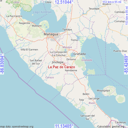
La Paz de Carazo GPS coordinates[2]
11° 49' 23.196" North, 86° 7' 40.116" West
| Map corner | latitude | longitude |
|---|---|---|
| Upper-left | 12.51044°, | -86.83094° |
| Center: | 11.82311°, | -86.12781° |
| Lower-right: | 11.13405°, | -85.42469° |
| Map W x H: | 153×153 km | = 95.1×95.1mi |
| max Lat: | 14.74189° ⇑85.6% North |
| La Paz de Carazo: | 11.82311° |
| min Lat: | ⇓14.4% South 10.94684° |
| min Long | La Paz de Caraz | max Long |
| -87.4516° | -86.12781° | -83.06145° |
| W 44.3%⇐ | ⇒55.7% E |
Elevation
Elevation of La Paz de Carazo is 396 m = 1299 ft, and this is 58.8 m = 193 ft above average elevation for this country.
| Max E: |
1288 m = 4226 ft | 38.9% |
| La Paz de Carazo | 396 m 1299 ft | |
| Avg. | 337.2 m = 1106 ft | |
Min E: |
1 m = 3 ft | 61.1% |
See also: Nicaragua elevation on elevation.city.
Geographical zone
La Paz de Carazo is located in North Torrid zone (between Equator and Tropic of Cancer). Distance of this Northern Tropic circle is 1291.3 km =802.4 mi to North.| Distance of | km | miles | from La Paz de Carazo |
|---|---|---|---|
| North Pole | 8692.5 | 5401.3 | to North |
| Arctic Circle | 6086.6 | 3782 | to North |
| Tropic Cancer | 1291.3 | 802.4 | to North |
| Equator | 1314.6 | 816.9 | to South |


Nearby cities:
15 places around La Paz de Carazo: (largest is in red/bold)
• Catarina
11.5 km =7.1 mi,  30°
30°
• Diriamba
12.7 km =7.9 mi,  287°
287°
• Diriomo
10.2 km =6.3 mi,  54°
54°
• Diriá
10.4 km =6.5 mi, 49°
• Dolores
10.3 km =6.4 mi, 291°
• El Rosario
4.2 km =2.6 mi,  284°
284°
• Jinotepe
8.3 km =5.2 mi, 290°
• La Conquista
12.2 km =7.6 mi,  215°
215°
• Masatepe
10.3 km =6.4 mi,  349°
349°
• Nandaime
11 km =6.8 mi,  132°
132°
• Nandasmo
11.3 km =7 mi,  3°
3°
• Niquinohomo
9.8 km =6.1 mi,  21°
21°
• San Juan de Oriente
11 km =6.8 mi, 32°
• San Marcos
12.7 km =7.9 mi,  319°
319°
• Santa Teresa
4.4 km =2.7 mi,  239°
239°
Sources, notices
• [Note1] Compared only with cities in Nicaragua existing in our database
• [Src1] Map data: © OpenStreetMap contributors (CC-BY-SA)
• [Src2] Other city data from geonames.org with taken over terms of usage.
• [Src3] Geographical zone / Annual Mean Temperature by Robert A. Rohde @ Wikipedia
