Rancho Grande geodata
Rancho Grande (Matagalpa) is a seat of a second-order administrative division; located in Nicaragua in America/Managua (GMT-6) time zone. In our database, there are 137 cities with bigger population. Compared to other cities in Nicaragua, 77.2% of cities are located further ↓South; 73.7% of cities are located further ←West and 83.2% of cities have lower elevation than Rancho Grande. Note1


Rancho Grande GPS coordinates[2]
13° 14' 13.02" North, 85° 33' 29.412" West
| Map corner | latitude | longitude |
|---|---|---|
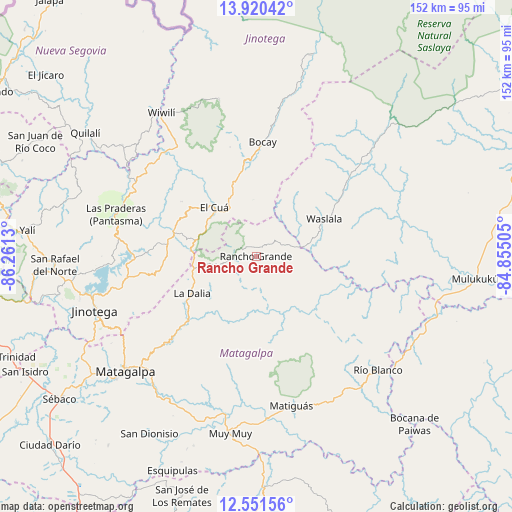
| Upper-left | 13.92042°, | -86.2613° |
| Center: | 13.23695°, | -85.55817° |
| Lower-right: | 12.55156°, | -84.85505° |
| Map W x H: | 152.2×152.2 km | = 94.6×94.6mi |
| max Lat: | 14.74189° ⇑22.8% North |
| Rancho Grande: | 13.23695° |
| min Lat: | ⇓77.2% South 10.94684° |
| min Long | Rancho Grande | max Long |
| -87.4516° | -85.55817° | -83.06145° |
| W 73.7%⇐ | ⇒26.3% E |
Elevation
Elevation of Rancho Grande is 616 m = 2021 ft, and this is 278.8 m = 915 ft above average elevation for this country.
| Max E: |
1288 m = 4226 ft | 16.8% |
| Rancho Grande | 616 m 2021 ft | |
| Avg. | 337.2 m = 1106 ft | |
Min E: |
1 m = 3 ft | 83.2% |
See also: Nicaragua elevation on elevation.city.
Geographical zone
Rancho Grande is located in North Torrid zone (between Equator and Tropic of Cancer). Distance of this Northern Tropic circle is 1134.1 km =704.7 mi to North.| Distance of | km | miles | from Rancho Grande |
|---|---|---|---|
| North Pole | 8535.3 | 5303.6 | to North |
| Arctic Circle | 5929.4 | 3684.4 | to North |
| Tropic Cancer | 1134.1 | 704.7 | to North |
| Equator | 1471.8 | 914.5 | to South |


Nearby cities:
15 places around Rancho Grande: (largest is in red/bold)
• El Cuá
19.2 km =11.9 mi,  319°
319°
• El Cuá
28.8 km =17.9 mi,  313°
313°
• Jinotega
50.8 km =31.6 mi,  251°
251°
• LLano de La Cruz
50.3 km =31.3 mi,  255°
255°
• La Dalia
22.4 km =13.9 mi,  240°
240°
• Las Praderas
32.5 km =20.2 mi, 256°
• Matiguás
45.6 km =28.3 mi,  166°
166°
• Río Blanco
49.5 km =30.8 mi,  132°
132°
• San José de Bocay
34 km =21.1 mi,  3°
3°
• San Ramón
46.3 km =28.8 mi,  221°
221°
• Santa Maía de Pantasma
43.6 km =27.1 mi,  286°
286°
• Waslala
18.9 km =11.7 mi,  91°
91°
• Waslala
23.1 km =14.4 mi,  61°
61°
• Wiwili
51.3 km =31.9 mi,  325°
325°
• Wiwilí de Jinotega
50.5 km =31.4 mi, 326°
Sources, notices
• [Note1] Compared only with cities in Nicaragua existing in our database
• [Src1] Map data: © OpenStreetMap contributors (CC-BY-SA)
• [Src2] Other city data from geonames.org with taken over terms of usage.
• [Src3] Geographical zone / Annual Mean Temperature by Robert A. Rohde @ Wikipedia
