Matiguás geodata
Matiguás (Matagalpa) is a seat of a second-order administrative division; located in Nicaragua in America/Managua (GMT-6) time zone. With population of 10,523 people, there are 44 cities with bigger population in this country. Compared to other cities in Nicaragua, 60.5% of cities are located further ↓South; 76.6% of cities are located further ←West and 50.3% of cities have higher elevation than Matiguás. Note1


Matiguás GPS coordinates[2]
12° 50' 14.424" North, 85° 27' 43.848" West
| Map corner | latitude | longitude |
|---|---|---|
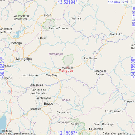
| Upper-left | 13.52194°, | -86.16531° |
| Center: | 12.83734°, | -85.46218° |
| Lower-right: | 12.15087°, | -84.75906° |
| Map W x H: | 152.4×152.5 km | = 94.7×94.8mi |
| max Lat: | 14.74189° ⇑39.5% North |
| Matiguás: | 12.83734° |
| min Lat: | ⇓60.5% South 10.94684° |
| min Long | Matiguás | max Long |
| -87.4516° | -85.46218° | -83.06145° |
| W 76.6%⇐ | ⇒23.4% E |
Elevation
Elevation of Matiguás is 300 m = 984 ft, and this is 37.2 m = 122 ft below average elevation for this country.
| Max E: |
1288 m = 4226 ft | 50.3% |
| Avg. | 337.2 m = 1106 ft | |
| Matiguás | 300 m = 984 ft | |
Min E: |
1 m = 3 ft | 49.7% |
See also: Nicaragua elevation on elevation.city.
Geographical zone
Matiguás is located in North Torrid zone (between Equator and Tropic of Cancer). Distance of this Northern Tropic circle is 1178.5 km =732.3 mi to North.| Distance of | km | miles | from Matiguás |
|---|---|---|---|
| North Pole | 8579.7 | 5331.2 | to North |
| Arctic Circle | 5973.8 | 3711.9 | to North |
| Tropic Cancer | 1178.5 | 732.3 | to North |
| Equator | 1427.4 | 886.9 | to South |


Nearby cities:
15 places around Matiguás: (largest is in red/bold)
• Boaco
45.8 km =28.5 mi,  207°
207°
• Bocana de Paiwas
37.3 km =23.2 mi,  98°
98°
• Camoapa
50.7 km =31.5 mi,  186°
186°
• Esquipulas
40.2 km =25 mi,  241°
241°
• La Dalia
44.7 km =27.8 mi,  318°
318°
• Matagalpa
50.3 km =31.3 mi,  281°
281°
• Muy Muy
19.9 km =12.4 mi,  245°
245°
• Rancho Grande
45.6 km =28.3 mi,  346°
346°
• Río Blanco
28 km =17.4 mi,  67°
67°
• San Dionisio
42.9 km =26.7 mi,  258°
258°
• San José de los Remates
42 km =26.1 mi,  230°
230°
• San Lorenzo
55.6 km =34.5 mi,  203°
203°
• San Ramón
41.9 km =26 mi, 283°
• Santa Lucía
43.3 km =26.9 mi,  218°
218°
• Waslala
44.9 km =27.9 mi,  10°
10°
Sources, notices
• [Note1] Compared only with cities in Nicaragua existing in our database
• [Src1] Map data: © OpenStreetMap contributors (CC-BY-SA)
• [Src2] Other city data from geonames.org with taken over terms of usage.
• [Src3] Geographical zone / Annual Mean Temperature by Robert A. Rohde @ Wikipedia
