Zonderwijk geodata
Zonderwijk (North Brabant) is a section of populated place; located in Netherlands in Europe/Amsterdam (GMT+2) time zone. With population of 3,435 people, there are 693 cities with bigger population in this country. Compared to other cities in Netherlands, 86% of cities are located further ↑North; 60.9% of cities are located further →East and 82.1% of cities have lower elevation than Zonderwijk. Note1


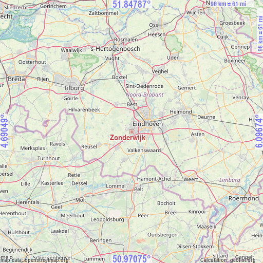
Zonderwijk GPS coordinates[2]
51° 24' 41.076" North, 5° 23' 36.996" East
| Map corner | latitude | longitude |
|---|---|---|
| Upper-left | 51.84787°, | 4.69049° |
| Center: | 51.41141°, | 5.39361° |
| Lower-right: | 50.97075°, | 6.09674° |
| Map W x H: | 97.5×97.5 km | = 60.6×60.6mi |
| max Lat: | 53.48025° ⇑86% North |
| Zonderwijk: | 51.41141° |
| min Lat: | ⇓14% South 50.76917° |
| min Long | Zonderwijk | max Long |
| 3.38611° | 5.39361° | 7.16528° |
| W 39.1%⇐ | ⇒60.9% E |
Elevation
Elevation of Zonderwijk is 23 m = 75 ft, and this is 8 m = 26 ft above average elevation for this country.
| Max E: |
203 m = 666 ft | 17.9% |
| Zonderwijk | 23 m 75 ft | |
| Avg. | 15 m = 49 ft | |
Min E: |
-6 m = -20 ft | 82.1% |
See also: Netherlands elevation on elevation.city.
Geographical zone
Zonderwijk is located in North temperate zone (between Tropic of Cancer and the Arctic Circle). Distance of this North polar circle is 1684.8 km =1046.9 mi to North.| Distance of | km | miles | from Zonderwijk |
|---|---|---|---|
| North Pole | 4290.6 | 2666.1 | to North |
| Arctic Circle | 1684.8 | 1046.9 | to North |
| Tropic Cancer | 3110.5 | 1932.8 | to South |
| Equator | 5716.4 | 3552 | to South |


Nearby cities:
15 places around Zonderwijk: (largest is in red/bold)
• Aalst
6.1 km =3.8 mi,  105°
105°
• Blaarthem
4.7 km =2.9 mi,  71°
71°
• Ekenrooi
6.6 km =4.1 mi,  104°
104°
• Grasrijk
3.4 km =2.1 mi,  26°
26°
• Lievendaal
4.4 km =2.7 mi,  39°
39°
• Meerhoven
3.7 km =2.3 mi,  19°
19°
• Meerveldhoven
1.7 km =1.1 mi, 68°
• Oerle
2 km =1.2 mi,  309°
309°
• Ooievaarsnest
2.8 km =1.7 mi,  78°
78°
• Riethoven
6.4 km =4 mi,  183°
183°
• Steensel
4.8 km =3 mi,  216°
216°
• Veldhoven
1 km =0.6 mi, 39°
• Voldijn
5.6 km =3.5 mi, 102°
• Waalre
4.5 km =2.8 mi,  127°
127°
• Zeelst
2.1 km =1.3 mi,  47°
47°
Sources, notices
• [Note1] Compared only with cities in Netherlands existing in our database
• [Src1] Map data: © OpenStreetMap contributors (CC-BY-SA)
• [Src2] Other city data from geonames.org with taken over terms of usage.
• [Src3] Geographical zone / Annual Mean Temperature by Robert A. Rohde @ Wikipedia
