Ekenrooi geodata
Ekenrooi (North Brabant) is a populated place; located in Netherlands in Europe/Amsterdam (GMT+2) time zone. With population of 3,970 people, there are 590 cities with bigger population in this country. Compared to other cities in Netherlands, 86.4% of cities are located further ↑North; 57.2% of cities are located further →East and 81.4% of cities have lower elevation than Ekenrooi. Note1


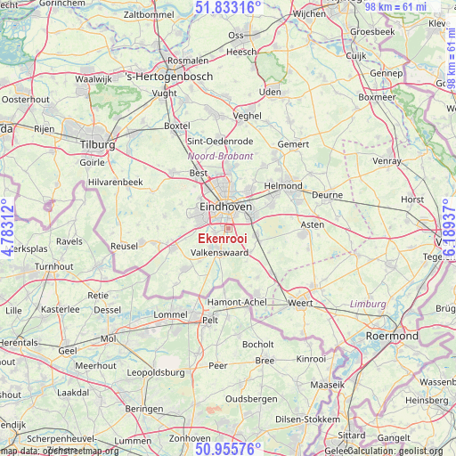
Ekenrooi GPS coordinates[2]
51° 23' 47.616" North, 5° 29' 10.464" East
| Map corner | latitude | longitude |
|---|---|---|
| Upper-left | 51.83316°, | 4.78312° |
| Center: | 51.39656°, | 5.48624° |
| Lower-right: | 50.95576°, | 6.18937° |
| Map W x H: | 97.6×97.6 km | = 60.6×60.6mi |
| max Lat: | 53.48025° ⇑86.4% North |
| Ekenrooi: | 51.39656° |
| min Lat: | ⇓13.6% South 50.76917° |
| min Long | Ekenrooi | max Long |
| 3.38611° | 5.48624° | 7.16528° |
| W 42.8%⇐ | ⇒57.2% E |
Elevation
Elevation of Ekenrooi is 22 m = 72 ft, and this is 7 m = 23 ft above average elevation for this country.
| Max E: |
203 m = 666 ft | 18.6% |
| Ekenrooi | 22 m 72 ft | |
| Avg. | 15 m = 49 ft | |
Min E: |
-6 m = -20 ft | 81.4% |
See also: Netherlands elevation on elevation.city.
Geographical zone
Ekenrooi is located in North temperate zone (between Tropic of Cancer and the Arctic Circle). Distance of this North polar circle is 1686.4 km =1047.9 mi to North.| Distance of | km | miles | from Ekenrooi |
|---|---|---|---|
| North Pole | 4292.3 | 2667.1 | to North |
| Arctic Circle | 1686.4 | 1047.9 | to North |
| Tropic Cancer | 3108.8 | 1931.7 | to South |
| Equator | 5714.8 | 3551 | to South |


Nearby cities:
15 places around Ekenrooi: (largest is in red/bold)
• Aalst
0.6 km =0.4 mi,  271°
271°
• Akert
5.4 km =3.4 mi,  69°
69°
• Blaarthem
3.7 km =2.3 mi,  328°
328°
• De Doornakkers
4.9 km =3 mi,  18°
18°
• Eindhoven
5 km =3.1 mi,  353°
353°
• Geenhoven
4.5 km =2.8 mi,  203°
203°
• Genoenhuis
3.9 km =2.4 mi, 68°
• Lakerlopen
4.7 km =2.9 mi,  12°
12°
• Ooievaarsnest
4.3 km =2.7 mi,  301°
301°
• Tivoli
3.1 km =1.9 mi,  29°
29°
• Valkenswaard
5.4 km =3.4 mi, 199°
• Villapark
5 km =3.1 mi, 6°
• Voldijn
1.1 km =0.7 mi,  293°
293°
• Waalre
3.1 km =1.9 mi,  249°
249°
• Zesgehuchten
5 km =3.1 mi,  63°
63°
Sources, notices
• [Note1] Compared only with cities in Netherlands existing in our database
• [Src1] Map data: © OpenStreetMap contributors (CC-BY-SA)
• [Src2] Other city data from geonames.org with taken over terms of usage.
• [Src3] Geographical zone / Annual Mean Temperature by Robert A. Rohde @ Wikipedia
