Blaarthem geodata
Blaarthem (North Brabant) is a section of populated place; located in Netherlands in Europe/Amsterdam (GMT+2) time zone. With population of 2,465 people, there are 849 cities with bigger population in this country. Compared to other cities in Netherlands, 84.9% of cities are located further ↑North; 58.6% of cities are located further →East and 74.9% of cities have lower elevation than Blaarthem. Note1


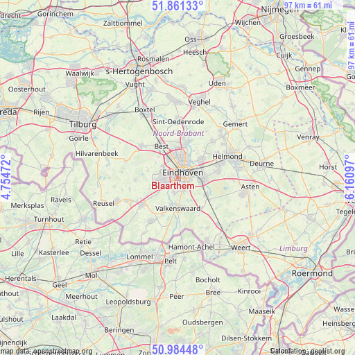
Blaarthem GPS coordinates[2]
51° 25' 30.036" North, 5° 27' 28.224" East
| Map corner | latitude | longitude |
|---|---|---|
| Upper-left | 51.86133°, | 4.75472° |
| Center: | 51.42501°, | 5.45784° |
| Lower-right: | 50.98448°, | 6.16097° |
| Map W x H: | 97.5×97.5 km | = 60.6×60.6mi |
| max Lat: | 53.48025° ⇑84.9% North |
| Blaarthem: | 51.42501° |
| min Lat: | ⇓15.1% South 50.76917° |
| min Long | Blaarthem | max Long |
| 3.38611° | 5.45784° | 7.16528° |
| W 41.4%⇐ | ⇒58.6% E |
Elevation
Elevation of Blaarthem is 18 m = 59 ft, and this is 3 m = 10 ft above average elevation for this country.
| Max E: |
203 m = 666 ft | 25.1% |
| Blaarthem | 18 m 59 ft | |
| Avg. | 15 m = 49 ft | |
Min E: |
-6 m = -20 ft | 74.9% |
See also: Netherlands elevation on elevation.city.
Geographical zone
Blaarthem is located in North temperate zone (between Tropic of Cancer and the Arctic Circle). Distance of this North polar circle is 1683.2 km =1045.9 mi to North.| Distance of | km | miles | from Blaarthem |
|---|---|---|---|
| North Pole | 4289.1 | 2665.1 | to North |
| Arctic Circle | 1683.2 | 1045.9 | to North |
| Tropic Cancer | 3112 | 1933.7 | to South |
| Equator | 5717.9 | 3552.9 | to South |


Nearby cities:
15 places around Blaarthem: (largest is in red/bold)
• Aalst
3.4 km =2.1 mi,  156°
156°
• De Doornakkers
3.8 km =2.4 mi,  67°
67°
• Eindhoven
2.2 km =1.4 mi,  38°
38°
• Ekenrooi
3.7 km =2.3 mi,  148°
148°
• Grasrijk
3.3 km =2.1 mi,  298°
298°
• Lakerlopen
3.3 km =2.1 mi,  64°
64°
• Lievendaal
2.5 km =1.6 mi,  319°
319°
• Meerhoven
3.8 km =2.4 mi, 301°
• Meerveldhoven
3 km =1.9 mi,  252°
252°
• Ooievaarsnest
1.9 km =1.2 mi,  241°
241°
• Tivoli
3.5 km =2.2 mi,  97°
97°
• Veldhoven
3.9 km =2.4 mi,  258°
258°
• Villapark
3.1 km =1.9 mi,  53°
53°
• Voldijn
2.9 km =1.8 mi, 160°
• Zeelst
2.9 km =1.8 mi,  268°
268°
Sources, notices
• [Note1] Compared only with cities in Netherlands existing in our database
• [Src1] Map data: © OpenStreetMap contributors (CC-BY-SA)
• [Src2] Other city data from geonames.org with taken over terms of usage.
• [Src3] Geographical zone / Annual Mean Temperature by Robert A. Rohde @ Wikipedia
