Wijthmen geodata
Wijthmen (Overijssel) is a populated place; located in Netherlands in Europe/Amsterdam (GMT+2) time zone. With population of 625 people, there are 1695 cities with bigger population in this country. Compared to other cities in Netherlands, 71.1% of cities are located further ↓South; 82.5% of cities are located further ←West and 65.8% of cities have higher elevation than Wijthmen. Note1


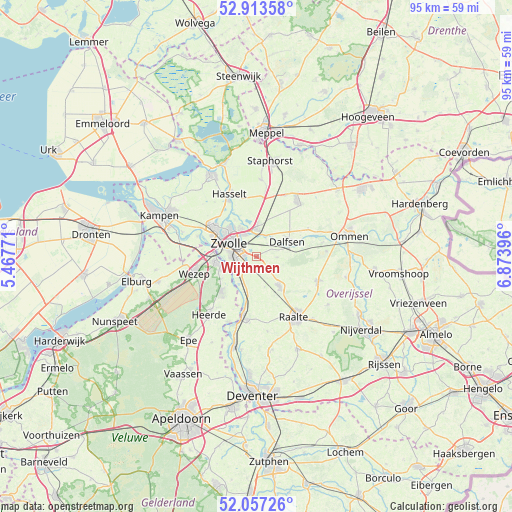
Wijthmen GPS coordinates[2]
52° 29' 15" North, 6° 10' 14.988" East
| Map corner | latitude | longitude |
|---|---|---|
| Upper-left | 52.91358°, | 5.46771° |
| Center: | 52.4875°, | 6.17083° |
| Lower-right: | 52.05726°, | 6.87396° |
| Map W x H: | 95.2×95.2 km | = 59.2×59.2mi |
| max Lat: | 53.48025° ⇑28.9% North |
| Wijthmen: | 52.4875° |
| min Lat: | ⇓71.1% South 50.76917° |
| min Long | Wijthmen | max Long |
| 3.38611° | 6.17083° | 7.16528° |
| W 82.5%⇐ | ⇒17.5% E |
Elevation
Elevation of Wijthmen is 3 m = 10 ft, and this is 12 m = 39 ft below average elevation for this country.
| Max E: |
203 m = 666 ft | 65.8% |
| Avg. | 15 m = 49 ft | |
| Wijthmen | 3 m = 10 ft | |
Min E: |
-6 m = -20 ft | 34.2% |
See also: Netherlands elevation on elevation.city.
Geographical zone
Wijthmen is located in North temperate zone (between Tropic of Cancer and the Arctic Circle). Distance of this North polar circle is 1565.1 km =972.5 mi to North.| Distance of | km | miles | from Wijthmen |
|---|---|---|---|
| North Pole | 4171 | 2591.7 | to North |
| Arctic Circle | 1565.1 | 972.5 | to North |
| Tropic Cancer | 3230.1 | 2007.1 | to South |
| Equator | 5836.1 | 3626.4 | to South |


Nearby cities:
15 places around Wijthmen: (largest is in red/bold)
• Berkum
4.7 km =2.9 mi,  330°
330°
• Brinkhoek
6.3 km =3.9 mi, 328°
• Dalfsen
6.4 km =4 mi,  65°
65°
• Elshof
10.7 km =6.6 mi,  169°
169°
• Frankhuis
8.1 km =5 mi,  300°
300°
• Hasselt
12.8 km =8 mi,  336°
336°
• Hattem
7.4 km =4.6 mi,  259°
259°
• Hattemerbroek
10.2 km =6.3 mi, 261°
• Heerde
14.2 km =8.8 mi,  218°
218°
• Heino
7 km =4.3 mi,  143°
143°
• Pierik
4.3 km =2.7 mi,  291°
291°
• Raalte
13.3 km =8.3 mi,  148°
148°
• Wapenveld
9.2 km =5.7 mi,  225°
225°
• Wijhe
11.5 km =7.1 mi,  192°
192°
• Zwolle
5.9 km =3.7 mi, 298°
Sources, notices
• [Note1] Compared only with cities in Netherlands existing in our database
• [Src1] Map data: © OpenStreetMap contributors (CC-BY-SA)
• [Src2] Other city data from geonames.org with taken over terms of usage.
• [Src3] Geographical zone / Annual Mean Temperature by Robert A. Rohde @ Wikipedia
