Warken geodata
Warken (Gelderland) is a populated place; located in Netherlands in Europe/Amsterdam (GMT+2) time zone. With population of 710 people, there are 1613 cities with bigger population in this country. Compared to other cities in Netherlands, 56.6% of cities are located further ↓South; 85% of cities are located further ←West and 55.1% of cities have lower elevation than Warken. Note1


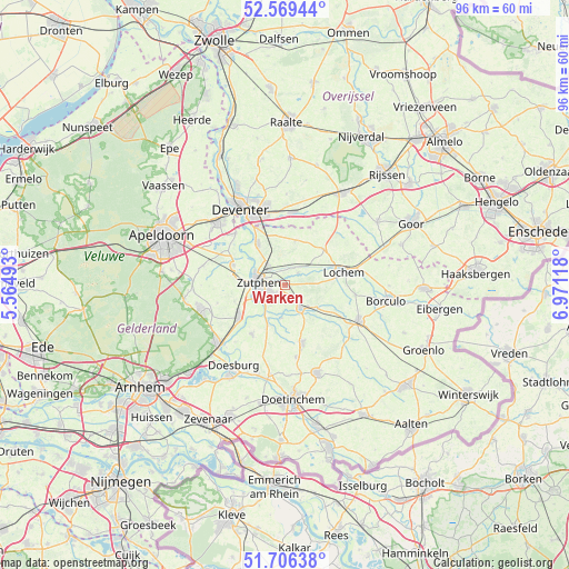
Warken GPS coordinates[2]
52° 8' 24" North, 6° 16' 5.016" East
| Map corner | latitude | longitude |
|---|---|---|
| Upper-left | 52.56944°, | 5.56493° |
| Center: | 52.14°, | 6.26806° |
| Lower-right: | 51.70638°, | 6.97118° |
| Map W x H: | 96×96 km | = 59.7×59.7mi |
| max Lat: | 53.48025° ⇑43.4% North |
| Warken: | 52.14° |
| min Lat: | ⇓56.6% South 50.76917° |
| min Long | Warken | max Long |
| 3.38611° | 6.26806° | 7.16528° |
| W 85%⇐ | ⇒15% E |
Elevation
Elevation of Warken is 8 m = 26 ft, and this is 7 m = 23 ft below average elevation for this country.
| Max E: |
203 m = 666 ft | 44.9% |
| Avg. | 15 m = 49 ft | |
| Warken | 8 m = 26 ft | |
Min E: |
-6 m = -20 ft | 55.1% |
See also: Netherlands elevation on elevation.city.
Geographical zone
Warken is located in North temperate zone (between Tropic of Cancer and the Arctic Circle). Distance of this North polar circle is 1603.7 km =996.5 mi to North.| Distance of | km | miles | from Warken |
|---|---|---|---|
| North Pole | 4209.6 | 2615.7 | to North |
| Arctic Circle | 1603.7 | 996.5 | to North |
| Tropic Cancer | 3191.5 | 1983.1 | to South |
| Equator | 5797.4 | 3602.3 | to South |


Nearby cities:
15 places around Warken: (largest is in red/bold)
• Almen
3 km =1.9 mi,  46°
46°
• Baak
7.5 km =4.7 mi,  201°
201°
• Brummen
9.5 km =5.9 mi,  234°
234°
• Eefde
4.2 km =2.6 mi,  315°
315°
• Empe
9 km =5.6 mi,  281°
281°
• Gorssel
8.2 km =5.1 mi,  326°
326°
• Harfsen
7.8 km =4.8 mi,  14°
14°
• Laren
9 km =5.6 mi, 47°
• Leesten
2.8 km =1.7 mi,  241°
241°
• Lochem
10 km =6.2 mi,  77°
77°
• Ooyerhoek
3.3 km =2.1 mi,  247°
247°
• Voorst
9.2 km =5.7 mi,  291°
291°
• Vorden
4.8 km =3 mi,  143°
143°
• Warnsveld
2.6 km =1.6 mi,  263°
263°
• Zutphen
4.6 km =2.9 mi,  267°
267°
Sources, notices
• [Note1] Compared only with cities in Netherlands existing in our database
• [Src1] Map data: © OpenStreetMap contributors (CC-BY-SA)
• [Src2] Other city data from geonames.org with taken over terms of usage.
• [Src3] Geographical zone / Annual Mean Temperature by Robert A. Rohde @ Wikipedia
