Vorden geodata
Vorden (Gelderland) is a populated place; located in Netherlands in Europe/Amsterdam (GMT+2) time zone. With population of 4,900 people, there are 494 cities with bigger population in this country. Compared to other cities in Netherlands, 54.8% of cities are located further ↓South; 85.8% of cities are located further ←West and 67% of cities have lower elevation than Vorden. Note1


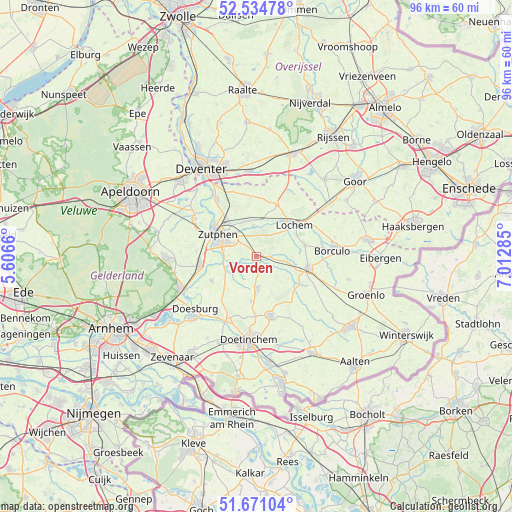
Vorden GPS coordinates[2]
52° 6' 18" North, 6° 18' 34.992" East
| Map corner | latitude | longitude |
|---|---|---|
| Upper-left | 52.53478°, | 5.6066° |
| Center: | 52.105°, | 6.30972° |
| Lower-right: | 51.67104°, | 7.01285° |
| Map W x H: | 96×96 km | = 59.7×59.7mi |
| max Lat: | 53.48025° ⇑45.2% North |
| Vorden: | 52.105° |
| min Lat: | ⇓54.8% South 50.76917° |
| min Long | Vorden | max Long |
| 3.38611° | 6.30972° | 7.16528° |
| W 85.8%⇐ | ⇒14.2% E |
Elevation
Elevation of Vorden is 13 m = 43 ft, and this is 2 m = 7 ft below average elevation for this country.
| Max E: |
203 m = 666 ft | 33% |
| Avg. | 15 m = 49 ft | |
| Vorden | 13 m = 43 ft | |
Min E: |
-6 m = -20 ft | 67% |
See also: Netherlands elevation on elevation.city.
Geographical zone
Vorden is located in North temperate zone (between Tropic of Cancer and the Arctic Circle). Distance of this North polar circle is 1607.6 km =998.9 mi to North.| Distance of | km | miles | from Vorden |
|---|---|---|---|
| North Pole | 4213.5 | 2618.1 | to North |
| Arctic Circle | 1607.6 | 998.9 | to North |
| Tropic Cancer | 3187.6 | 1980.7 | to South |
| Equator | 5793.5 | 3599.9 | to South |


Nearby cities:
15 places around Vorden: (largest is in red/bold)
• Almen
6 km =3.7 mi,  353°
353°
• Baak
6.4 km =4 mi,  241°
241°
• Barchem
9.4 km =5.8 mi,  76°
76°
• Eefde
9 km =5.6 mi,  319°
319°
• Hengelo
6 km =3.7 mi,  180°
180°
• Keijenborg
8.5 km =5.3 mi,  187°
187°
• Laren
10.6 km =6.6 mi,  20°
20°
• Leesten
5.9 km =3.7 mi,  295°
295°
• Lochem
9.2 km =5.7 mi,  48°
48°
• Ooyerhoek
6.5 km =4 mi,  293°
293°
• Ruurlo
9.8 km =6.1 mi,  100°
100°
• Steenderen
9.5 km =5.9 mi, 241°
• Warken
4.8 km =3 mi, 323°
• Warnsveld
6.5 km =4 mi, 303°
• Zutphen
8.3 km =5.2 mi, 296°
Sources, notices
• [Note1] Compared only with cities in Netherlands existing in our database
• [Src1] Map data: © OpenStreetMap contributors (CC-BY-SA)
• [Src2] Other city data from geonames.org with taken over terms of usage.
• [Src3] Geographical zone / Annual Mean Temperature by Robert A. Rohde @ Wikipedia
