Brummen geodata
Brummen (Gelderland) is a populated place; located in Netherlands in Europe/Amsterdam (GMT+2) time zone. With population of 21,344 people, there are 161 cities with bigger population in this country. Compared to other cities in Netherlands, 54.3% of cities are located further ↓South; 81.9% of cities are located further ←West and 64.6% of cities have lower elevation than Brummen. Note1


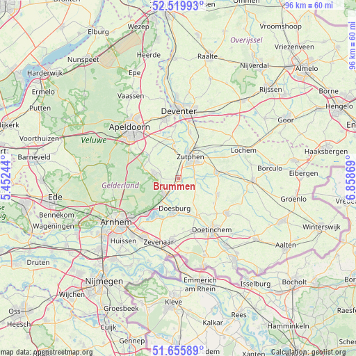
Brummen GPS coordinates[2]
52° 5' 24" North, 6° 9' 20.016" East
| Map corner | latitude | longitude |
|---|---|---|
| Upper-left | 52.51993°, | 5.45244° |
| Center: | 52.09°, | 6.15556° |
| Lower-right: | 51.65589°, | 6.85869° |
| Map W x H: | 96.1×96.1 km | = 59.7×59.7mi |
| max Lat: | 53.48025° ⇑45.7% North |
| Brummen: | 52.09° |
| min Lat: | ⇓54.3% South 50.76917° |
| min Long | Brummen | max Long |
| 3.38611° | 6.15556° | 7.16528° |
| W 81.9%⇐ | ⇒18.1% E |
Elevation
Elevation of Brummen is 12 m = 39 ft, and this is 3 m = 10 ft below average elevation for this country.
| Max E: |
203 m = 666 ft | 35.4% |
| Avg. | 15 m = 49 ft | |
| Brummen | 12 m = 39 ft | |
Min E: |
-6 m = -20 ft | 64.6% |
See also: Netherlands elevation on elevation.city.
Geographical zone
Brummen is located in North temperate zone (between Tropic of Cancer and the Arctic Circle). Distance of this North polar circle is 1609.3 km =1000 mi to North.| Distance of | km | miles | from Brummen |
|---|---|---|---|
| North Pole | 4215.2 | 2619.2 | to North |
| Arctic Circle | 1609.3 | 1000 | to North |
| Tropic Cancer | 3185.9 | 1979.6 | to South |
| Equator | 5791.9 | 3598.9 | to South |


Nearby cities:
15 places around Brummen: (largest is in red/bold)
• Baak
5.1 km =3.2 mi,  105°
105°
• Dieren
5.6 km =3.5 mi,  222°
222°
• Doesburg
8.7 km =5.4 mi,  187°
187°
• Drempt
9.3 km =5.8 mi,  171°
171°
• Eerbeek
6.8 km =4.2 mi,  284°
284°
• Ellecom
7.9 km =4.9 mi, 216°
• Empe
7.4 km =4.6 mi,  351°
351°
• Laag-Soeren
5.5 km =3.4 mi,  263°
263°
• Leesten
6.7 km =4.2 mi,  51°
51°
• Ooyerhoek
6.3 km =3.9 mi, 47°
• Spankeren
4.6 km =2.9 mi, 219°
• Steenderen
3.6 km =2.2 mi,  142°
142°
• Voorst
8.9 km =5.5 mi, 353°
• Warnsveld
7.4 km =4.6 mi,  44°
44°
• Zutphen
6.2 km =3.9 mi,  30°
30°
Sources, notices
• [Note1] Compared only with cities in Netherlands existing in our database
• [Src1] Map data: © OpenStreetMap contributors (CC-BY-SA)
• [Src2] Other city data from geonames.org with taken over terms of usage.
• [Src3] Geographical zone / Annual Mean Temperature by Robert A. Rohde @ Wikipedia
