Waddinxveen geodata
Waddinxveen (South Holland) is a populated place; located in Netherlands in Europe/Amsterdam (GMT+2) time zone. With population of 25,338 people, there are 134 cities with bigger population in this country. Compared to other cities in Netherlands, 51.4% of cities are located further ↓South; 84.9% of cities are located further →East and 96.1% of cities have higher elevation than Waddinxveen. Note1


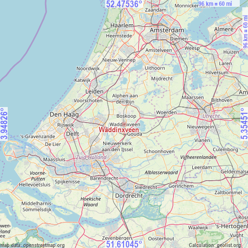
Waddinxveen GPS coordinates[2]
52° 2' 42" North, 4° 39' 5.004" East
| Map corner | latitude | longitude |
|---|---|---|
| Upper-left | 52.47536°, | 3.94826° |
| Center: | 52.045°, | 4.65139° |
| Lower-right: | 51.61045°, | 5.35451° |
| Map W x H: | 96.2×96.2 km | = 59.8×59.8mi |
| max Lat: | 53.48025° ⇑48.6% North |
| Waddinxveen: | 52.045° |
| min Lat: | ⇓51.4% South 50.76917° |
| min Long | Waddinxveen | max Long |
| 3.38611° | 4.65139° | 7.16528° |
| W 15.1%⇐ | ⇒84.9% E |
Elevation
Elevation of Waddinxveen is -1 m = -3 ft, and this is 16 m = 52 ft below average elevation for this country.
| Max E: |
203 m = 666 ft | 96.1% |
| Avg. | 15 m = 49 ft | |
| Waddinxveen | -1 m = -3 ft | |
Min E: |
-6 m = -20 ft | 3.9% |
See also: Netherlands elevation on elevation.city.
Geographical zone
Waddinxveen is located in North temperate zone (between Tropic of Cancer and the Arctic Circle). Distance of this North polar circle is 1614.3 km =1003.1 mi to North.| Distance of | km | miles | from Waddinxveen |
|---|---|---|---|
| North Pole | 4220.2 | 2622.3 | to North |
| Arctic Circle | 1614.3 | 1003.1 | to North |
| Tropic Cancer | 3180.9 | 1976.5 | to South |
| Equator | 5786.9 | 3595.8 | to South |


Nearby cities:
15 places around Waddinxveen: (largest is in red/bold)
• Alphen aan den Rijn
9.4 km =5.8 mi,  1°
1°
• Benthuizen
8.2 km =5.1 mi,  296°
296°
• Bleiswijk
9 km =5.6 mi,  245°
245°
• Bloemendaal
3.5 km =2.2 mi,  121°
121°
• Bodegraven
7.9 km =4.9 mi,  58°
58°
• Boskoop
3.3 km =2.1 mi, 4°
• Gouda
5 km =3.1 mi,  128°
128°
• Gouderak
7 km =4.3 mi,  165°
165°
• Gouwsluis
8.4 km =5.2 mi,  8°
8°
• Groenswaard
0.8 km =0.5 mi,  330°
330°
• Oranjewijk
0.5 km =0.3 mi,  18°
18°
• Reeuwijk
5 km =3.1 mi,  87°
87°
• Vondelwijk
1.1 km =0.7 mi, 6°
• Voorweg
5.3 km =3.3 mi,  336°
336°
• Zuidzijde
9.1 km =5.7 mi, 64°
Sources, notices
• [Note1] Compared only with cities in Netherlands existing in our database
• [Src1] Map data: © OpenStreetMap contributors (CC-BY-SA)
• [Src2] Other city data from geonames.org with taken over terms of usage.
• [Src3] Geographical zone / Annual Mean Temperature by Robert A. Rohde @ Wikipedia
