Oranjewijk geodata
Oranjewijk (South Holland) is a section of populated place; located in Netherlands in Europe/Amsterdam (GMT+2) time zone. With population of 2,650 people, there are 812 cities with bigger population in this country. Compared to other cities in Netherlands, 51.7% of cities are located further ↓South; 84.8% of cities are located further →East and 99.9% of cities have higher elevation than Oranjewijk. Note1


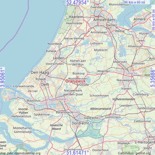
Oranjewijk GPS coordinates[2]
52° 2' 57.192" North, 4° 39' 13.464" East
| Map corner | latitude | longitude |
|---|---|---|
| Upper-left | 52.47954°, | 3.95061° |
| Center: | 52.04922°, | 4.65374° |
| Lower-right: | 51.61471°, | 5.35686° |
| Map W x H: | 96.2×96.2 km | = 59.8×59.8mi |
| max Lat: | 53.48025° ⇑48.3% North |
| Oranjewijk: | 52.04922° |
| min Lat: | ⇓51.7% South 50.76917° |
| min Long | Oranjewijk | max Long |
| 3.38611° | 4.65374° | 7.16528° |
| W 15.2%⇐ | ⇒84.8% E |
Elevation
Elevation of Oranjewijk is -5 m = -16 ft, and this is 20 m = 66 ft below average elevation for this country.
| Max E: |
203 m = 666 ft | 99.9% |
| Avg. | 15 m = 49 ft | |
| Oranjewijk | -5 m = -16 ft | |
Min E: |
-6 m = -20 ft | 0.1% |
See also: Netherlands elevation on elevation.city.
Geographical zone
Oranjewijk is located in North temperate zone (between Tropic of Cancer and the Arctic Circle). Distance of this North polar circle is 1613.8 km =1002.8 mi to North.| Distance of | km | miles | from Oranjewijk |
|---|---|---|---|
| North Pole | 4219.7 | 2622 | to North |
| Arctic Circle | 1613.8 | 1002.8 | to North |
| Tropic Cancer | 3181.4 | 1976.8 | to South |
| Equator | 5787.3 | 3596.1 | to South |


Nearby cities:
15 places around Oranjewijk: (largest is in red/bold)
• Alphen aan den Rijn
8.9 km =5.5 mi,  0°
0°
• Benthuizen
8.1 km =5 mi,  292°
292°
• Bleiswijk
9.4 km =5.8 mi,  242°
242°
• Bloemendaal
3.6 km =2.2 mi,  129°
129°
• Bodegraven
7.5 km =4.7 mi,  60°
60°
• Boskoop
2.9 km =1.8 mi, 2°
• Gouda
5.2 km =3.2 mi, 134°
• Gouderak
7.4 km =4.6 mi,  167°
167°
• Gouwsluis
7.9 km =4.9 mi,  7°
7°
• Groenswaard
0.6 km =0.4 mi, 294°
• Reeuwijk
4.9 km =3 mi,  93°
93°
• Vondelwijk
0.6 km =0.4 mi,  356°
356°
• Voorweg
5 km =3.1 mi,  333°
333°
• Waddinxveen
0.5 km =0.3 mi,  198°
198°
• Zuidzijde
8.8 km =5.5 mi,  67°
67°
Sources, notices
• [Note1] Compared only with cities in Netherlands existing in our database
• [Src1] Map data: © OpenStreetMap contributors (CC-BY-SA)
• [Src2] Other city data from geonames.org with taken over terms of usage.
• [Src3] Geographical zone / Annual Mean Temperature by Robert A. Rohde @ Wikipedia
