Gouda geodata
Gouda (South Holland) is a populated place; located in Netherlands in Europe/Amsterdam (GMT+2) time zone. With population of 71,952 people, there are 41 cities with bigger population in this country. Compared to other cities in Netherlands, 50.1% of cities are located further ↓South; 82.8% of cities are located further →East and 83.9% of cities have higher elevation than Gouda. Note1


Gouda GPS coordinates[2]
52° 1' 0.012" North, 4° 42' 29.988" East
| Map corner | latitude | longitude |
|---|---|---|
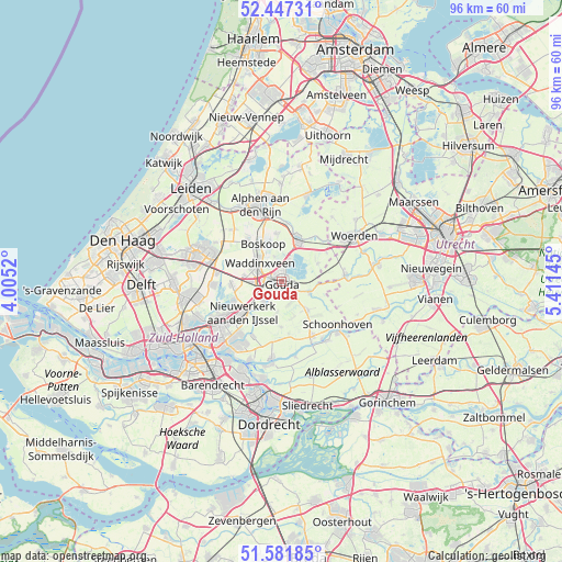
| Upper-left | 52.44731°, | 4.0052° |
| Center: | 52.01667°, | 4.70833° |
| Lower-right: | 51.58185°, | 5.41145° |
| Map W x H: | 96.2×96.2 km | = 59.8×59.8mi |
| max Lat: | 53.48025° ⇑49.9% North |
| Gouda: | 52.01667° |
| min Lat: | ⇓50.1% South 50.76917° |
| min Long | Gouda | max Long |
| 3.38611° | 4.70833° | 7.16528° |
| W 17.2%⇐ | ⇒82.8% E |
Elevation
Elevation of Gouda is 1 m = 3 ft, and this is 14 m = 46 ft below average elevation for this country.
| Max E: |
203 m = 666 ft | 83.9% |
| Avg. | 15 m = 49 ft | |
| Gouda | 1 m = 3 ft | |
Min E: |
-6 m = -20 ft | 16.1% |
See also: Gouda elevation on elevation.city.
Geographical zone
Gouda is located in North temperate zone (between Tropic of Cancer and the Arctic Circle). Distance of this North polar circle is 1617.5 km =1005.1 mi to North.| Distance of | km | miles | from Gouda |
|---|---|---|---|
| North Pole | 4223.4 | 2624.3 | to North |
| Arctic Circle | 1617.5 | 1005.1 | to North |
| Tropic Cancer | 3177.8 | 1974.6 | to South |
| Equator | 5783.7 | 3593.8 | to South |


Nearby cities:
15 places around Gouda: (largest is in red/bold)
• Berkenwoude
8 km =5 mi,  180°
180°
• Bloemendaal
1.6 km =1 mi,  324°
324°
• Bodegraven
7.9 km =4.9 mi,  21°
21°
• Boskoop
7.4 km =4.6 mi,  330°
330°
• Driebruggen
7 km =4.3 mi,  64°
64°
• Gouderak
4.2 km =2.6 mi,  210°
210°
• Groenswaard
5.8 km =3.6 mi,  312°
312°
• Haastrecht
5 km =3.1 mi,  110°
110°
• Oranjewijk
5.2 km =3.2 mi, 314°
• Reeuwijk
3.5 km =2.2 mi, 18°
• Stein
5.3 km =3.3 mi, 106°
• Stolwijk
6.6 km =4.1 mi,  137°
137°
• Vondelwijk
5.7 km =3.5 mi, 318°
• Waddinxveen
5 km =3.1 mi, 308°
• Zuidzijde
8.3 km =5.2 mi,  31°
31°
Sources, notices
• [Note1] Compared only with cities in Netherlands existing in our database
• [Src1] Map data: © OpenStreetMap contributors (CC-BY-SA)
• [Src2] Other city data from geonames.org with taken over terms of usage.
• [Src3] Geographical zone / Annual Mean Temperature by Robert A. Rohde @ Wikipedia
