Gouderak geodata
Gouderak (South Holland) is a populated place; located in Netherlands in Europe/Amsterdam (GMT+2) time zone. With population of 2,635 people, there are 814 cities with bigger population in this country. Compared to other cities in Netherlands, 52.2% of cities are located further ↑North; 83.7% of cities are located further →East and 96.1% of cities have higher elevation than Gouderak. Note1


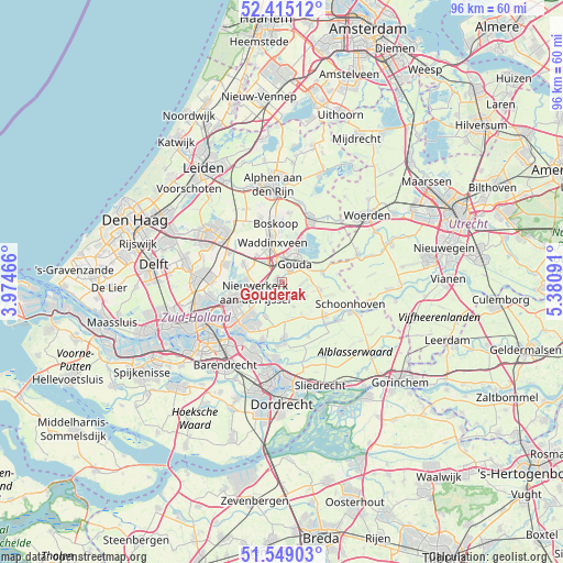
Gouderak GPS coordinates[2]
51° 59' 3.012" North, 4° 40' 40.008" East
| Map corner | latitude | longitude |
|---|---|---|
| Upper-left | 52.41512°, | 3.97466° |
| Center: | 51.98417°, | 4.67778° |
| Lower-right: | 51.54903°, | 5.38091° |
| Map W x H: | 96.3×96.3 km | = 59.8×59.8mi |
| max Lat: | 53.48025° ⇑52.2% North |
| Gouderak: | 51.98417° |
| min Lat: | ⇓47.8% South 50.76917° |
| min Long | Gouderak | max Long |
| 3.38611° | 4.67778° | 7.16528° |
| W 16.3%⇐ | ⇒83.7% E |
Elevation
Elevation of Gouderak is -1 m = -3 ft, and this is 16 m = 52 ft below average elevation for this country.
| Max E: |
203 m = 666 ft | 96.1% |
| Avg. | 15 m = 49 ft | |
| Gouderak | -1 m = -3 ft | |
Min E: |
-6 m = -20 ft | 3.9% |
See also: Netherlands elevation on elevation.city.
Geographical zone
Gouderak is located in North temperate zone (between Tropic of Cancer and the Arctic Circle). Distance of this North polar circle is 1621.1 km =1007.3 mi to North.| Distance of | km | miles | from Gouderak |
|---|---|---|---|
| North Pole | 4227 | 2626.5 | to North |
| Arctic Circle | 1621.1 | 1007.3 | to North |
| Tropic Cancer | 3174.2 | 1972.4 | to South |
| Equator | 5780.1 | 3591.6 | to South |


Nearby cities:
15 places around Gouderak: (largest is in red/bold)
• Berkenwoude
4.8 km =3 mi,  155°
155°
• Bloemendaal
5.1 km =3.2 mi,  12°
12°
• Capelle aan den IJssel
9.2 km =5.7 mi,  228°
228°
• Gouda
4.2 km =2.6 mi,  30°
30°
• Groenswaard
7.8 km =4.8 mi,  343°
343°
• Haastrecht
7 km =4.3 mi,  74°
74°
• Krimpen aan den IJssel
9.1 km =5.7 mi,  214°
214°
• Ommoord
9.5 km =5.9 mi,  253°
253°
• Oranjewijk
7.4 km =4.6 mi,  347°
347°
• Ouderkerk aan den IJssel
6.2 km =3.9 mi, 207°
• Reeuwijk
7.7 km =4.8 mi,  24°
24°
• Stein
7.4 km =4.6 mi, 73°
• Stolwijk
6.7 km =4.2 mi,  101°
101°
• Vondelwijk
8.1 km =5 mi, 347°
• Waddinxveen
7 km =4.3 mi, 345°
Sources, notices
• [Note1] Compared only with cities in Netherlands existing in our database
• [Src1] Map data: © OpenStreetMap contributors (CC-BY-SA)
• [Src2] Other city data from geonames.org with taken over terms of usage.
• [Src3] Geographical zone / Annual Mean Temperature by Robert A. Rohde @ Wikipedia
