Tjalleberd geodata
Tjalleberd (Friesland) is a populated place; located in Netherlands in Europe/Amsterdam (GMT+2) time zone. With population of 815 people, there are 1518 cities with bigger population in this country. Compared to other cities in Netherlands, 85.5% of cities are located further ↓South; 67.3% of cities are located further ←West and 91.3% of cities have higher elevation than Tjalleberd. Note1


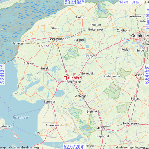
Tjalleberd GPS coordinates[2]
52° 59' 50.244" North, 5° 56' 39.948" East
| Map corner | latitude | longitude |
|---|---|---|
| Upper-left | 53.4184°, | 5.24131° |
| Center: | 52.99729°, | 5.94443° |
| Lower-right: | 52.57204°, | 6.64756° |
| Map W x H: | 94.1×94.1 km | = 58.5×58.5mi |
| max Lat: | 53.48025° ⇑14.5% North |
| Tjalleberd: | 52.99729° |
| min Lat: | ⇓85.5% South 50.76917° |
| min Long | Tjalleberd | max Long |
| 3.38611° | 5.94443° | 7.16528° |
| W 67.3%⇐ | ⇒32.7% E |
Elevation
Elevation of Tjalleberd is 0 m = 0 ft, and this is 15 m = 49 ft below average elevation for this country.
| Max E: |
203 m = 666 ft | 91.3% |
| Avg. | 15 m = 49 ft | |
| Tjalleberd | 0 m = 0 ft | |
Min E: |
-6 m = -20 ft | 8.7% |
See also: Netherlands elevation on elevation.city.
Geographical zone
Tjalleberd is located in North temperate zone (between Tropic of Cancer and the Arctic Circle). Distance of this North polar circle is 1508.4 km =937.3 mi to North.| Distance of | km | miles | from Tjalleberd |
|---|---|---|---|
| North Pole | 4114.3 | 2556.5 | to North |
| Arctic Circle | 1508.4 | 937.3 | to North |
| Tropic Cancer | 3286.8 | 2042.3 | to South |
| Equator | 5892.7 | 3661.6 | to South |


Nearby cities:
15 places around Tjalleberd: (largest is in red/bold)
• Aldeboarn
6.6 km =4.1 mi,  333°
333°
• De Greiden
5.7 km =3.5 mi,  201°
201°
• De Knipe
3.7 km =2.3 mi,  150°
150°
• Gorredijk
8.1 km =5 mi,  82°
82°
• Heerenveen
4.6 km =2.9 mi, 202°
• Katlijk
7.3 km =4.5 mi,  141°
141°
• Langezwaag
4.2 km =2.6 mi,  112°
112°
• Mildam
7.9 km =4.9 mi, 150°
• Nes
8.7 km =5.4 mi,  314°
314°
• Oranjewoud
5.7 km =3.5 mi,  176°
176°
• Oudehaske
6.6 km =4.1 mi,  227°
227°
• Oudeschoot
7.1 km =4.4 mi,  173°
173°
• Rottum
7.5 km =4.7 mi,  206°
206°
• Terwispel
7.4 km =4.6 mi,  70°
70°
• Tijnje
4.9 km =3 mi,  40°
40°
Sources, notices
• [Note1] Compared only with cities in Netherlands existing in our database
• [Src1] Map data: © OpenStreetMap contributors (CC-BY-SA)
• [Src2] Other city data from geonames.org with taken over terms of usage.
• [Src3] Geographical zone / Annual Mean Temperature by Robert A. Rohde @ Wikipedia
