Roosteren geodata
Roosteren (Limburg) is a populated place; located in Netherlands in Europe/Amsterdam (GMT+2) time zone. With population of 1,125 people, there are 1318 cities with bigger population in this country. Compared to other cities in Netherlands, 92.7% of cities are located further ↑North; 58.7% of cities are located further ←West and 87.2% of cities have lower elevation than Roosteren. Note1


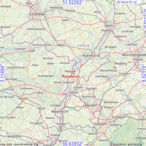
Roosteren GPS coordinates[2]
51° 4' 59.988" North, 5° 49' 5.016" East
| Map corner | latitude | longitude |
|---|---|---|
| Upper-left | 51.52292°, | 5.11494° |
| Center: | 51.08333°, | 5.81806° |
| Lower-right: | 50.63952°, | 6.52119° |
| Map W x H: | 98.2×98.2 km | = 61×61mi |
| max Lat: | 53.48025° ⇑92.7% North |
| Roosteren: | 51.08333° |
| min Lat: | ⇓7.3% South 50.76917° |
| min Long | Roosteren | max Long |
| 3.38611° | 5.81806° | 7.16528° |
| W 58.7%⇐ | ⇒41.3% E |
Elevation
Elevation of Roosteren is 29 m = 95 ft, and this is 14 m = 46 ft above average elevation for this country.
| Max E: |
203 m = 666 ft | 12.8% |
| Roosteren | 29 m 95 ft | |
| Avg. | 15 m = 49 ft | |
Min E: |
-6 m = -20 ft | 87.2% |
See also: Netherlands elevation on elevation.city.
Geographical zone
Roosteren is located in North temperate zone (between Tropic of Cancer and the Arctic Circle). Distance of this North polar circle is 1721.2 km =1069.5 mi to North.| Distance of | km | miles | from Roosteren |
|---|---|---|---|
| North Pole | 4327.1 | 2688.7 | to North |
| Arctic Circle | 1721.2 | 1069.5 | to North |
| Tropic Cancer | 3074 | 1910.1 | to South |
| Equator | 5679.9 | 3529.3 | to South |


Nearby cities:
15 places around Roosteren: (largest is in red/bold)
• Born
5.8 km =3.6 mi,  185°
185°
• Buchten
4.5 km =2.8 mi, 187°
• Dieteren
2.1 km =1.3 mi,  110°
110°
• Grevenbicht
5.8 km =3.6 mi,  211°
211°
• Guttecoven
7.6 km =4.7 mi,  180°
180°
• Heide
4.1 km =2.5 mi, 113°
• Hingen
6.1 km =3.8 mi,  66°
66°
• Holtum
4 km =2.5 mi, 175°
• Maasbracht
7.8 km =4.8 mi,  37°
37°
• Obbicht
6.7 km =4.2 mi,  203°
203°
• Papenhoven
5.3 km =3.3 mi, 213°
• Peij
5.6 km =3.5 mi,  77°
77°
• Schilberg
5.1 km =3.2 mi, 69°
• Sint Joost
6.8 km =4.2 mi,  55°
55°
• Slek
4.4 km =2.7 mi,  85°
85°
Sources, notices
• [Note1] Compared only with cities in Netherlands existing in our database
• [Src1] Map data: © OpenStreetMap contributors (CC-BY-SA)
• [Src2] Other city data from geonames.org with taken over terms of usage.
• [Src3] Geographical zone / Annual Mean Temperature by Robert A. Rohde @ Wikipedia
