Guttecoven geodata
Guttecoven (Limburg) is a populated place; located in Netherlands in Europe/Amsterdam (GMT+2) time zone. With population of 1,260 people, there are 1260 cities with bigger population in this country. Compared to other cities in Netherlands, 93.2% of cities are located further ↑North; 58.7% of cities are located further ←West and 92.8% of cities have lower elevation than Guttecoven. Note1


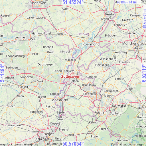
Guttecoven GPS coordinates[2]
51° 0' 54" North, 5° 49' 5.016" East
| Map corner | latitude | longitude |
|---|---|---|
| Upper-left | 51.45524°, | 5.11494° |
| Center: | 51.015°, | 5.81806° |
| Lower-right: | 50.57054°, | 6.52119° |
| Map W x H: | 98.4×98.4 km | = 61.1×61.1mi |
| max Lat: | 53.48025° ⇑93.2% North |
| Guttecoven: | 51.015° |
| min Lat: | ⇓6.8% South 50.76917° |
| min Long | Guttecoven | max Long |
| 3.38611° | 5.81806° | 7.16528° |
| W 58.7%⇐ | ⇒41.3% E |
Elevation
Elevation of Guttecoven is 46 m = 151 ft, and this is 31 m = 102 ft above average elevation for this country.
| Max E: |
203 m = 666 ft | 7.2% |
| Guttecoven | 46 m 151 ft | |
| Avg. | 15 m = 49 ft | |
Min E: |
-6 m = -20 ft | 92.8% |
See also: Netherlands elevation on elevation.city.
Geographical zone
Guttecoven is located in North temperate zone (between Tropic of Cancer and the Arctic Circle). Distance of this North polar circle is 1728.8 km =1074.2 mi to North.| Distance of | km | miles | from Guttecoven |
|---|---|---|---|
| North Pole | 4334.7 | 2693.5 | to North |
| Arctic Circle | 1728.8 | 1074.2 | to North |
| Tropic Cancer | 3066.4 | 1905.4 | to South |
| Equator | 5672.3 | 3524.6 | to South |


Nearby cities:
15 places around Guttecoven: (largest is in red/bold)
• Berg
3.5 km =2.2 mi,  249°
249°
• Born
1.9 km =1.2 mi,  342°
342°
• Buchten
3.2 km =2 mi,  349°
349°
• Einighausen
1.6 km =1 mi,  155°
155°
• Grevenbicht
4 km =2.5 mi,  310°
310°
• Holtum
3.6 km =2.2 mi,  4°
4°
• Limbricht
1.4 km =0.9 mi,  105°
105°
• Lindenheuvel
3.3 km =2.1 mi,  181°
181°
• Obbicht
3 km =1.9 mi,  299°
299°
• Ophoven
3.9 km =2.4 mi,  133°
133°
• Overhoven
3.4 km =2.1 mi,  101°
101°
• Papenhoven
4.3 km =2.7 mi,  317°
317°
• Sittard
4 km =2.5 mi,  117°
117°
• Stadbroek
4.3 km =2.7 mi, 109°
• Urmond
4.2 km =2.6 mi,  230°
230°
Sources, notices
• [Note1] Compared only with cities in Netherlands existing in our database
• [Src1] Map data: © OpenStreetMap contributors (CC-BY-SA)
• [Src2] Other city data from geonames.org with taken over terms of usage.
• [Src3] Geographical zone / Annual Mean Temperature by Robert A. Rohde @ Wikipedia
