Reijmerstok geodata
Reijmerstok (Limburg) is a populated place; located in Netherlands in Europe/Amsterdam (GMT+2) time zone. With population of 520 people, there are 1811 cities with bigger population in this country. Compared to other cities in Netherlands, 99.4% of cities are located further ↑North; 60.2% of cities are located further ←West and 99.7% of cities have lower elevation than Reijmerstok. Note1


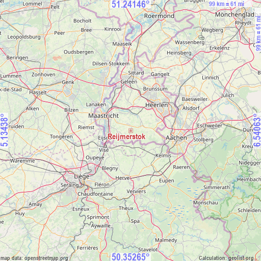
Reijmerstok GPS coordinates[2]
50° 47' 57.012" North, 5° 50' 15" East
| Map corner | latitude | longitude |
|---|---|---|
| Upper-left | 51.24146°, | 5.13438° |
| Center: | 50.79917°, | 5.8375° |
| Lower-right: | 50.35265°, | 6.54063° |
| Map W x H: | 98.8×98.8 km | = 61.4×61.4mi |
| max Lat: | 53.48025° ⇑99.4% North |
| Reijmerstok: | 50.79917° |
| min Lat: | ⇓0.6% South 50.76917° |
| min Long | Reijmerstok | max Long |
| 3.38611° | 5.8375° | 7.16528° |
| W 60.2%⇐ | ⇒39.8% E |
Elevation
Elevation of Reijmerstok is 175 m = 574 ft, and this is 160 m = 525 ft above average elevation for this country.
| Max E: |
203 m = 666 ft | 0.3% |
| Reijmerstok | 175 m 574 ft | |
| Avg. | 15 m = 49 ft | |
Min E: |
-6 m = -20 ft | 99.7% |
See also: Netherlands elevation on elevation.city.
Geographical zone
Reijmerstok is located in North temperate zone (between Tropic of Cancer and the Arctic Circle). Distance of this North polar circle is 1752.8 km =1089.1 mi to North.| Distance of | km | miles | from Reijmerstok |
|---|---|---|---|
| North Pole | 4358.7 | 2708.4 | to North |
| Arctic Circle | 1752.8 | 1089.1 | to North |
| Tropic Cancer | 3042.4 | 1890.5 | to South |
| Equator | 5648.3 | 3509.7 | to South |


Nearby cities:
15 places around Reijmerstok: (largest is in red/bold)
• Banholt
2.3 km =1.4 mi,  243°
243°
• Eckelrade
5.2 km =3.2 mi,  280°
280°
• Epen
5.8 km =3.6 mi,  116°
116°
• Gulpen
4.1 km =2.5 mi,  62°
62°
• Margraten
2.7 km =1.7 mi,  334°
334°
• Mechelen
6.3 km =3.9 mi,  93°
93°
• Mheer
3.9 km =2.4 mi, 236°
• Noorbeek
3.8 km =2.4 mi,  207°
207°
• Rijckholt
7.4 km =4.6 mi,  270°
270°
• Schin op Geul
6.5 km =4 mi,  20°
20°
• Sibbe
5.1 km =3.2 mi,  351°
351°
• Sint Geertruid
5.1 km =3.2 mi, 266°
• Valkenburg
7.4 km =4.6 mi,  357°
357°
• Vilt
6.9 km =4.3 mi,  342°
342°
• Wijlre
5.6 km =3.5 mi,  47°
47°
Sources, notices
• [Note1] Compared only with cities in Netherlands existing in our database
• [Src1] Map data: © OpenStreetMap contributors (CC-BY-SA)
• [Src2] Other city data from geonames.org with taken over terms of usage.
• [Src3] Geographical zone / Annual Mean Temperature by Robert A. Rohde @ Wikipedia
