Wijlre geodata
Wijlre (Limburg) is a populated place; located in Netherlands in Europe/Amsterdam (GMT+2) time zone. With population of 1,960 people, there are 972 cities with bigger population in this country. Compared to other cities in Netherlands, 98.8% of cities are located further ↑North; 64% of cities are located further ←West and 97.2% of cities have lower elevation than Wijlre. Note1


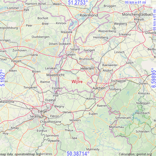
Wijlre GPS coordinates[2]
50° 49' 59.988" North, 5° 53' 44.988" East
| Map corner | latitude | longitude |
|---|---|---|
| Upper-left | 51.2753°, | 5.1927° |
| Center: | 50.83333°, | 5.89583° |
| Lower-right: | 50.38714°, | 6.59895° |
| Map W x H: | 98.8×98.8 km | = 61.4×61.4mi |
| max Lat: | 53.48025° ⇑98.8% North |
| Wijlre: | 50.83333° |
| min Lat: | ⇓1.2% South 50.76917° |
| min Long | Wijlre | max Long |
| 3.38611° | 5.89583° | 7.16528° |
| W 64%⇐ | ⇒36% E |
Elevation
Elevation of Wijlre is 103 m = 338 ft, and this is 88 m = 289 ft above average elevation for this country.
| Max E: |
203 m = 666 ft | 2.8% |
| Wijlre | 103 m 338 ft | |
| Avg. | 15 m = 49 ft | |
Min E: |
-6 m = -20 ft | 97.2% |
See also: Netherlands elevation on elevation.city.
Geographical zone
Wijlre is located in North temperate zone (between Tropic of Cancer and the Arctic Circle). Distance of this North polar circle is 1749 km =1086.8 mi to North.| Distance of | km | miles | from Wijlre |
|---|---|---|---|
| North Pole | 4354.9 | 2706 | to North |
| Arctic Circle | 1749 | 1086.8 | to North |
| Tropic Cancer | 3046.2 | 1892.8 | to South |
| Equator | 5652.1 | 3512.1 | to South |


Nearby cities:
15 places around Wijlre: (largest is in red/bold)
• Gulpen
2 km =1.2 mi,  194°
194°
• Klimmen
4.8 km =3 mi,  347°
347°
• Kunrade
5.5 km =3.4 mi,  26°
26°
• Margraten
5.4 km =3.4 mi,  255°
255°
• Mechelen
4.7 km =2.9 mi,  152°
152°
• Nijswiller
5.1 km =3.2 mi,  122°
122°
• Ransdaal
3.5 km =2.2 mi,  355°
355°
• Reijmerstok
5.6 km =3.5 mi,  227°
227°
• Schin op Geul
3 km =1.9 mi,  321°
321°
• Sibbe
5 km =3.1 mi,  283°
283°
• Simpelveld
6 km =3.7 mi,  89°
89°
• Termaar
3.9 km =2.4 mi, 352°
• Ubachsberg
4.3 km =2.7 mi,  59°
59°
• Valkenburg
5.7 km =3.5 mi,  308°
308°
• Voerendaal
6 km =3.7 mi,  23°
23°
Sources, notices
• [Note1] Compared only with cities in Netherlands existing in our database
• [Src1] Map data: © OpenStreetMap contributors (CC-BY-SA)
• [Src2] Other city data from geonames.org with taken over terms of usage.
• [Src3] Geographical zone / Annual Mean Temperature by Robert A. Rohde @ Wikipedia
