Raam geodata
Raam (North Brabant) is a populated place; located in Netherlands in Europe/Amsterdam (GMT+2) time zone. With population of 2,965 people, there are 763 cities with bigger population in this country. Compared to other cities in Netherlands, 70.8% of cities are located further ↑North; 50.6% of cities are located further →East and 80.4% of cities have lower elevation than Raam. Note1


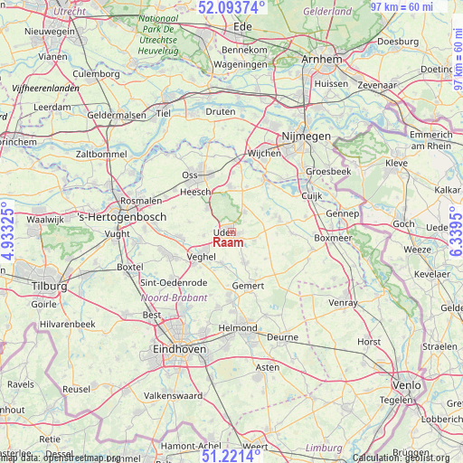
Raam GPS coordinates[2]
51° 39' 34.812" North, 5° 38' 10.932" East
| Map corner | latitude | longitude |
|---|---|---|
| Upper-left | 52.09374°, | 4.93325° |
| Center: | 51.65967°, | 5.63637° |
| Lower-right: | 51.2214°, | 6.3395° |
| Map W x H: | 97×97 km | = 60.3×60.3mi |
| max Lat: | 53.48025° ⇑70.8% North |
| Raam: | 51.65967° |
| min Lat: | ⇓29.2% South 50.76917° |
| min Long | Raam | max Long |
| 3.38611° | 5.63637° | 7.16528° |
| W 49.4%⇐ | ⇒50.6% E |
Elevation
Elevation of Raam is 21 m = 69 ft, and this is 6 m = 20 ft above average elevation for this country.
| Max E: |
203 m = 666 ft | 19.6% |
| Raam | 21 m 69 ft | |
| Avg. | 15 m = 49 ft | |
Min E: |
-6 m = -20 ft | 80.4% |
See also: Netherlands elevation on elevation.city.
Geographical zone
Raam is located in North temperate zone (between Tropic of Cancer and the Arctic Circle). Distance of this North polar circle is 1657.2 km =1029.7 mi to North.| Distance of | km | miles | from Raam |
|---|---|---|---|
| North Pole | 4263 | 2648.9 | to North |
| Arctic Circle | 1657.2 | 1029.7 | to North |
| Tropic Cancer | 3138.1 | 1949.9 | to South |
| Equator | 5744 | 3569.2 | to South |


Nearby cities:
15 places around Raam: (largest is in red/bold)
• Bitswijk
2.1 km =1.3 mi,  298°
298°
• Boekel
6.8 km =4.2 mi,  156°
156°
• Eikenheuvel
2.9 km =1.8 mi,  217°
217°
• Erp
6.9 km =4.3 mi,  197°
197°
• Hoeven
1.4 km =0.9 mi,  354°
354°
• Mariaheide
4.8 km =3 mi,  232°
232°
• Melle
0.4 km =0.2 mi,  328°
328°
• Nistelrode
7.1 km =4.4 mi,  314°
314°
• Odiliapeel
5.1 km =3.2 mi,  110°
110°
• Uden
1.2 km =0.7 mi,  276°
276°
• Veghel
7.7 km =4.8 mi, 231°
• Ven
6.3 km =3.9 mi,  249°
249°
• Volkel
2.3 km =1.4 mi,  147°
147°
• Vorstenbosch
6 km =3.7 mi,  262°
262°
• Zeeland
5 km =3.1 mi,  33°
33°
Sources, notices
• [Note1] Compared only with cities in Netherlands existing in our database
• [Src1] Map data: © OpenStreetMap contributors (CC-BY-SA)
• [Src2] Other city data from geonames.org with taken over terms of usage.
• [Src3] Geographical zone / Annual Mean Temperature by Robert A. Rohde @ Wikipedia
