Meijel geodata
Meijel (Limburg) is a populated place; located in Netherlands in Europe/Amsterdam (GMT+2) time zone. With population of 5,180 people, there are 466 cities with bigger population in this country. Compared to other cities in Netherlands, 88.3% of cities are located further ↑North; 63.2% of cities are located further ←West and 91.5% of cities have lower elevation than Meijel. Note1


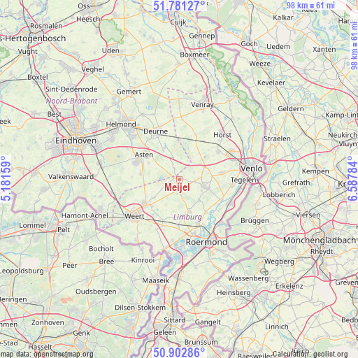
Meijel GPS coordinates[2]
51° 20' 39.012" North, 5° 53' 4.992" East
| Map corner | latitude | longitude |
|---|---|---|
| Upper-left | 51.78127°, | 5.18159° |
| Center: | 51.34417°, | 5.88472° |
| Lower-right: | 50.90286°, | 6.58784° |
| Map W x H: | 97.7×97.7 km | = 60.7×60.7mi |
| max Lat: | 53.48025° ⇑88.3% North |
| Meijel: | 51.34417° |
| min Lat: | ⇓11.7% South 50.76917° |
| min Long | Meijel | max Long |
| 3.38611° | 5.88472° | 7.16528° |
| W 63.2%⇐ | ⇒36.8% E |
Elevation
Elevation of Meijel is 37 m = 121 ft, and this is 22 m = 72 ft above average elevation for this country.
| Max E: |
203 m = 666 ft | 8.5% |
| Meijel | 37 m 121 ft | |
| Avg. | 15 m = 49 ft | |
Min E: |
-6 m = -20 ft | 91.5% |
See also: Netherlands elevation on elevation.city.
Geographical zone
Meijel is located in North temperate zone (between Tropic of Cancer and the Arctic Circle). Distance of this North polar circle is 1692.2 km =1051.5 mi to North.| Distance of | km | miles | from Meijel |
|---|---|---|---|
| North Pole | 4298.1 | 2670.7 | to North |
| Arctic Circle | 1692.2 | 1051.5 | to North |
| Tropic Cancer | 3103 | 1928.1 | to South |
| Equator | 5708.9 | 3547.3 | to South |


Nearby cities:
15 places around Meijel: (largest is in red/bold)
• Beringe
4.5 km =2.8 mi,  100°
100°
• Budschop
10.9 km =6.8 mi,  233°
233°
• Egchel
6.9 km =4.3 mi,  118°
118°
• Grashoek
4.5 km =2.8 mi,  65°
65°
• Helden
8.5 km =5.3 mi,  109°
109°
• Helenaveen
5.6 km =3.5 mi,  23°
23°
• Heusden
9.5 km =5.9 mi,  297°
297°
• Heythuysen
10.5 km =6.5 mi,  174°
174°
• Koningslust
7.7 km =4.8 mi,  78°
78°
• Leveroy
10.9 km =6.8 mi,  193°
193°
• Liessel
8.9 km =5.5 mi,  330°
330°
• Neerkant
3 km =1.9 mi, 334°
• Ospel
8.7 km =5.4 mi, 233°
• Panningen
6.8 km =4.2 mi, 106°
• Someren-Eind
10.6 km =6.6 mi,  278°
278°
Sources, notices
• [Note1] Compared only with cities in Netherlands existing in our database
• [Src1] Map data: © OpenStreetMap contributors (CC-BY-SA)
• [Src2] Other city data from geonames.org with taken over terms of usage.
• [Src3] Geographical zone / Annual Mean Temperature by Robert A. Rohde @ Wikipedia
