Orden geodata
Orden (Gelderland) is a section of populated place; located in Netherlands in Europe/Amsterdam (GMT+2) time zone. With population of 6,385 people, there are 388 cities with bigger population in this country. Compared to other cities in Netherlands, 60.6% of cities are located further ↓South; 66.7% of cities are located further ←West and 83.5% of cities have lower elevation than Orden. Note1


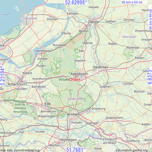
Orden GPS coordinates[2]
52° 12' 4.068" North, 5° 56' 3.012" East
| Map corner | latitude | longitude |
|---|---|---|
| Upper-left | 52.62998°, | 5.23104° |
| Center: | 52.20113°, | 5.93417° |
| Lower-right: | 51.7681°, | 6.6373° |
| Map W x H: | 95.8×95.8 km | = 59.5×59.5mi |
| max Lat: | 53.48025° ⇑39.4% North |
| Orden: | 52.20113° |
| min Lat: | ⇓60.6% South 50.76917° |
| min Long | Orden | max Long |
| 3.38611° | 5.93417° | 7.16528° |
| W 66.7%⇐ | ⇒33.3% E |
Elevation
Elevation of Orden is 25 m = 82 ft, and this is 10 m = 33 ft above average elevation for this country.
| Max E: |
203 m = 666 ft | 16.5% |
| Orden | 25 m 82 ft | |
| Avg. | 15 m = 49 ft | |
Min E: |
-6 m = -20 ft | 83.5% |
See also: Netherlands elevation on elevation.city.
Geographical zone
Orden is located in North temperate zone (between Tropic of Cancer and the Arctic Circle). Distance of this North polar circle is 1597 km =992.3 mi to North.| Distance of | km | miles | from Orden |
|---|---|---|---|
| North Pole | 4202.8 | 2611.5 | to North |
| Arctic Circle | 1597 | 992.3 | to North |
| Tropic Cancer | 3198.3 | 1987.3 | to South |
| Equator | 5804.2 | 3606.6 | to South |


Nearby cities:
15 places around Orden: (largest is in red/bold)
• Berg en Bos
2.1 km =1.3 mi,  358°
358°
• Binnenstad
2.2 km =1.4 mi,  52°
52°
• Brinkhorst
1.8 km =1.1 mi,  42°
42°
• Brummelhof
2.3 km =1.4 mi,  79°
79°
• Componistenkwartier
2.5 km =1.6 mi,  120°
120°
• De Bouwhof
2 km =1.2 mi,  153°
153°
• De Heeze
1.3 km =0.8 mi,  92°
92°
• Driehuizen
1.1 km =0.7 mi, 39°
• Spainkbos
2.5 km =1.6 mi,  20°
20°
• Sprengenbos
2.1 km =1.3 mi,  14°
14°
• Sprengenweg-Noord
2.2 km =1.4 mi,  30°
30°
• Ugchelen
1.8 km =1.1 mi,  185°
185°
• Vogelkwartier
2.3 km =1.4 mi,  99°
99°
• Westenenk
1.6 km =1 mi,  109°
109°
• Winkewijert
2 km =1.2 mi,  125°
125°
Sources, notices
• [Note1] Compared only with cities in Netherlands existing in our database
• [Src1] Map data: © OpenStreetMap contributors (CC-BY-SA)
• [Src2] Other city data from geonames.org with taken over terms of usage.
• [Src3] Geographical zone / Annual Mean Temperature by Robert A. Rohde @ Wikipedia
