Winkewijert geodata
Winkewijert (Gelderland) is a section of populated place; located in Netherlands in Europe/Amsterdam (GMT+2) time zone. With population of 1,760 people, there are 1030 cities with bigger population in this country. Compared to other cities in Netherlands, 59.4% of cities are located further ↓South; 68.6% of cities are located further ←West and 78.8% of cities have lower elevation than Winkewijert. Note1


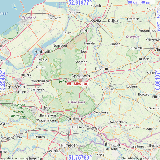
Winkewijert GPS coordinates[2]
52° 11' 26.952" North, 5° 57' 28.584" East
| Map corner | latitude | longitude |
|---|---|---|
| Upper-left | 52.61977°, | 5.25482° |
| Center: | 52.19082°, | 5.95794° |
| Lower-right: | 51.75769°, | 6.66107° |
| Map W x H: | 95.9×95.9 km | = 59.6×59.6mi |
| max Lat: | 53.48025° ⇑40.6% North |
| Winkewijert: | 52.19082° |
| min Lat: | ⇓59.4% South 50.76917° |
| min Long | Winkewijert | max Long |
| 3.38611° | 5.95794° | 7.16528° |
| W 68.6%⇐ | ⇒31.4% E |
Elevation
Elevation of Winkewijert is 20 m = 66 ft, and this is 5 m = 16 ft above average elevation for this country.
| Max E: |
203 m = 666 ft | 21.2% |
| Winkewijert | 20 m 66 ft | |
| Avg. | 15 m = 49 ft | |
Min E: |
-6 m = -20 ft | 78.8% |
See also: Netherlands elevation on elevation.city.
Geographical zone
Winkewijert is located in North temperate zone (between Tropic of Cancer and the Arctic Circle). Distance of this North polar circle is 1598.1 km =993 mi to North.| Distance of | km | miles | from Winkewijert |
|---|---|---|---|
| North Pole | 4204 | 2612.2 | to North |
| Arctic Circle | 1598.1 | 993 | to North |
| Tropic Cancer | 3197.2 | 1986.6 | to South |
| Equator | 5803.1 | 3605.9 | to South |


Nearby cities:
15 places around Winkewijert: (largest is in red/bold)
• Apeldoorn
2.3 km =1.4 mi,  20°
20°
• Binnenstad
2.5 km =1.6 mi,  2°
2°
• Brummelhof
1.7 km =1.1 mi, 23°
• Componistenkwartier
0.6 km =0.4 mi,  101°
101°
• De Bouwhof
1 km =0.6 mi,  231°
231°
• De Haven
2.4 km =1.5 mi,  26°
26°
• De Heeze
1.1 km =0.7 mi,  344°
344°
• Driehuizen
2.2 km =1.4 mi, 335°
• Matendreef
2.2 km =1.4 mi,  62°
62°
• Orden
2 km =1.2 mi,  305°
305°
• Rivierenkwartier
1.3 km =0.8 mi, 98°
• Staatsliedenkwartier
1.6 km =1 mi,  53°
53°
• Ugchelen
1.9 km =1.2 mi,  248°
248°
• Vogelkwartier
1 km =0.6 mi,  39°
39°
• Westenenk
0.6 km =0.4 mi,  351°
351°
Sources, notices
• [Note1] Compared only with cities in Netherlands existing in our database
• [Src1] Map data: © OpenStreetMap contributors (CC-BY-SA)
• [Src2] Other city data from geonames.org with taken over terms of usage.
• [Src3] Geographical zone / Annual Mean Temperature by Robert A. Rohde @ Wikipedia
