Oosterhout geodata
Oosterhout (North Brabant) is a populated place; located in Netherlands in Europe/Amsterdam (GMT+2) time zone. With population of 53,107 people, there are 57 cities with bigger population in this country. Compared to other cities in Netherlands, 71.7% of cities are located further ↑North; 77.6% of cities are located further →East and 52.4% of cities have lower elevation than Oosterhout. Note1


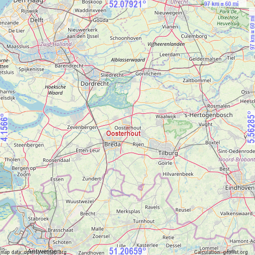
Oosterhout GPS coordinates[2]
51° 38' 42" North, 4° 51' 34.992" East
| Map corner | latitude | longitude |
|---|---|---|
| Upper-left | 52.07921°, | 4.1566° |
| Center: | 51.645°, | 4.85972° |
| Lower-right: | 51.20659°, | 5.56285° |
| Map W x H: | 97×97 km | = 60.3×60.3mi |
| max Lat: | 53.48025° ⇑71.7% North |
| Oosterhout: | 51.645° |
| min Lat: | ⇓28.3% South 50.76917° |
| min Long | Oosterhout | max Long |
| 3.38611° | 4.85972° | 7.16528° |
| W 22.4%⇐ | ⇒77.6% E |
Elevation
Elevation of Oosterhout is 7 m = 23 ft, and this is 8 m = 26 ft below average elevation for this country.
| Max E: |
203 m = 666 ft | 47.6% |
| Avg. | 15 m = 49 ft | |
| Oosterhout | 7 m = 23 ft | |
Min E: |
-6 m = -20 ft | 52.4% |
See also: Oosterhout elevation on elevation.city.
Geographical zone
Oosterhout is located in North temperate zone (between Tropic of Cancer and the Arctic Circle). Distance of this North polar circle is 1658.8 km =1030.7 mi to North.| Distance of | km | miles | from Oosterhout |
|---|---|---|---|
| North Pole | 4264.7 | 2650 | to North |
| Arctic Circle | 1658.8 | 1030.7 | to North |
| Tropic Cancer | 3136.5 | 1948.9 | to South |
| Equator | 5742.4 | 3568.2 | to South |


Nearby cities:
15 places around Oosterhout: (largest is in red/bold)
• 's Gravenmoer
5.7 km =3.5 mi,  77°
77°
• Biesdonk
6.7 km =4.2 mi,  229°
229°
• Den Hout
3.5 km =2.2 mi,  293°
293°
• Dongen
5.8 km =3.6 mi,  110°
110°
• Dorst
6.1 km =3.8 mi,  181°
181°
• Geertruidenberg
6.3 km =3.9 mi,  358°
358°
• Heusdenhout
6.9 km =4.3 mi,  203°
203°
• Hoge Vucht
6.3 km =3.9 mi, 228°
• Made
5.8 km =3.6 mi,  307°
307°
• Oosteind
2.6 km =1.6 mi,  91°
91°
• Raamsdonk
5.8 km =3.6 mi,  35°
35°
• Raamsdonksveer
5.8 km =3.6 mi,  9°
9°
• Teteringen
4.8 km =3 mi,  213°
213°
• Waterdonken
5.5 km =3.4 mi,  224°
224°
• Wisselaar
6.3 km =3.9 mi,  235°
235°
Sources, notices
• [Note1] Compared only with cities in Netherlands existing in our database
• [Src1] Map data: © OpenStreetMap contributors (CC-BY-SA)
• [Src2] Other city data from geonames.org with taken over terms of usage.
• [Src3] Geographical zone / Annual Mean Temperature by Robert A. Rohde @ Wikipedia
