Olland geodata
Olland (North Brabant) is a populated place; located in Netherlands in Europe/Amsterdam (GMT+2) time zone. With population of 580 people, there are 1743 cities with bigger population in this country. Compared to other cities in Netherlands, 75% of cities are located further ↑North; 60.2% of cities are located further →East and 59.4% of cities have lower elevation than Olland. Note1


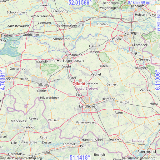
Olland GPS coordinates[2]
51° 34' 50.988" North, 5° 24' 24.984" East
| Map corner | latitude | longitude |
|---|---|---|
| Upper-left | 52.01566°, | 4.70381° |
| Center: | 51.58083°, | 5.40694° |
| Lower-right: | 51.1418°, | 6.11006° |
| Map W x H: | 97.2×97.2 km | = 60.4×60.4mi |
| max Lat: | 53.48025° ⇑75% North |
| Olland: | 51.58083° |
| min Lat: | ⇓25% South 50.76917° |
| min Long | Olland | max Long |
| 3.38611° | 5.40694° | 7.16528° |
| W 39.8%⇐ | ⇒60.2% E |
Elevation
Elevation of Olland is 10 m = 33 ft, and this is 5 m = 16 ft below average elevation for this country.
| Max E: |
203 m = 666 ft | 40.6% |
| Avg. | 15 m = 49 ft | |
| Olland | 10 m = 33 ft | |
Min E: |
-6 m = -20 ft | 59.4% |
See also: Netherlands elevation on elevation.city.
Geographical zone
Olland is located in North temperate zone (between Tropic of Cancer and the Arctic Circle). Distance of this North polar circle is 1665.9 km =1035.1 mi to North.| Distance of | km | miles | from Olland |
|---|---|---|---|
| North Pole | 4271.8 | 2654.4 | to North |
| Arctic Circle | 1665.9 | 1035.1 | to North |
| Tropic Cancer | 3129.3 | 1944.5 | to South |
| Equator | 5735.3 | 3563.7 | to South |


Nearby cities:
15 places around Olland: (largest is in red/bold)
• Best
8.2 km =5.1 mi,  188°
188°
• Boskant
3.6 km =2.2 mi,  164°
164°
• Boxtel
5.5 km =3.4 mi,  281°
281°
• Eerde
6.8 km =4.2 mi,  67°
67°
• Eerschot
4.8 km =3 mi,  106°
106°
• Gemonde
5.4 km =3.4 mi,  320°
320°
• Lennisheuvel
6.4 km =4 mi,  261°
261°
• Liempde
2.7 km =1.7 mi,  241°
241°
• Nijnsel
6.2 km =3.9 mi,  122°
122°
• Salderes
7.4 km =4.6 mi, 189°
• Schijndel
4.9 km =3 mi,  20°
20°
• Sint-Michielsgestel
7.7 km =4.8 mi,  331°
331°
• Sint-Oedenrode
3.9 km =2.4 mi, 112°
• Theereheide
8 km =5 mi, 323°
• Wijbosch
5.8 km =3.6 mi,  46°
46°
Sources, notices
• [Note1] Compared only with cities in Netherlands existing in our database
• [Src1] Map data: © OpenStreetMap contributors (CC-BY-SA)
• [Src2] Other city data from geonames.org with taken over terms of usage.
• [Src3] Geographical zone / Annual Mean Temperature by Robert A. Rohde @ Wikipedia
