Lennisheuvel geodata
Lennisheuvel (North Brabant) is a populated place; located in Netherlands in Europe/Amsterdam (GMT+2) time zone. With population of 855 people, there are 1490 cities with bigger population in this country. Compared to other cities in Netherlands, 75.6% of cities are located further ↑North; 63% of cities are located further →East and 62% of cities have lower elevation than Lennisheuvel. Note1


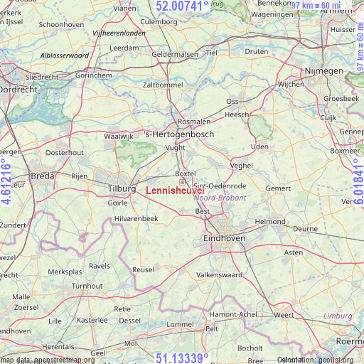
Lennisheuvel GPS coordinates[2]
51° 34' 21" North, 5° 18' 55.008" East
| Map corner | latitude | longitude |
|---|---|---|
| Upper-left | 52.00741°, | 4.61216° |
| Center: | 51.5725°, | 5.31528° |
| Lower-right: | 51.13339°, | 6.01841° |
| Map W x H: | 97.2×97.2 km | = 60.4×60.4mi |
| max Lat: | 53.48025° ⇑75.6% North |
| Lennisheuvel: | 51.5725° |
| min Lat: | ⇓24.4% South 50.76917° |
| min Long | Lennisheuvel | max Long |
| 3.38611° | 5.31528° | 7.16528° |
| W 37%⇐ | ⇒63% E |
Elevation
Elevation of Lennisheuvel is 11 m = 36 ft, and this is 4 m = 13 ft below average elevation for this country.
| Max E: |
203 m = 666 ft | 38% |
| Avg. | 15 m = 49 ft | |
| Lennisheuvel | 11 m = 36 ft | |
Min E: |
-6 m = -20 ft | 62% |
See also: Netherlands elevation on elevation.city.
Geographical zone
Lennisheuvel is located in North temperate zone (between Tropic of Cancer and the Arctic Circle). Distance of this North polar circle is 1666.8 km =1035.7 mi to North.| Distance of | km | miles | from Lennisheuvel |
|---|---|---|---|
| North Pole | 4272.7 | 2654.9 | to North |
| Arctic Circle | 1666.8 | 1035.7 | to North |
| Tropic Cancer | 3128.4 | 1943.9 | to South |
| Equator | 5734.3 | 3563.1 | to South |


Nearby cities:
15 places around Lennisheuvel: (largest is in red/bold)
• Best
8.9 km =5.5 mi,  144°
144°
• Boskant
7.7 km =4.8 mi,  108°
108°
• Boxtel
2.3 km =1.4 mi,  25°
25°
• Esch
4.6 km =2.9 mi,  337°
337°
• Gemonde
5.9 km =3.7 mi, 29°
• Haaren
7.2 km =4.5 mi,  297°
297°
• Helvoirt
8.8 km =5.5 mi,  318°
318°
• Liempde
4 km =2.5 mi,  95°
95°
• Oirschot
7.5 km =4.7 mi,  180°
180°
• Oisterwijk
8.8 km =5.5 mi,  274°
274°
• Olland
6.4 km =4 mi,  81°
81°
• Salderes
8.2 km =5.1 mi, 141°
• Sint-Michielsgestel
8.1 km =5 mi,  18°
18°
• Spoordonk
6.8 km =4.2 mi,  206°
206°
• Theereheide
7.5 km =4.7 mi,  11°
11°
Sources, notices
• [Note1] Compared only with cities in Netherlands existing in our database
• [Src1] Map data: © OpenStreetMap contributors (CC-BY-SA)
• [Src2] Other city data from geonames.org with taken over terms of usage.
• [Src3] Geographical zone / Annual Mean Temperature by Robert A. Rohde @ Wikipedia
