Nieuwkoop geodata
Nieuwkoop (South Holland) is a populated place; located in Netherlands in Europe/Amsterdam (GMT+2) time zone. With population of 1,410 people, there are 1174 cities with bigger population in this country. Compared to other cities in Netherlands, 57% of cities are located further ↓South; 80.9% of cities are located further →East and 99.9% of cities have higher elevation than Nieuwkoop. Note1


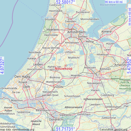
Nieuwkoop GPS coordinates[2]
52° 9' 2.988" North, 4° 46' 35.004" East
| Map corner | latitude | longitude |
|---|---|---|
| Upper-left | 52.58017°, | 4.07327° |
| Center: | 52.15083°, | 4.77639° |
| Lower-right: | 51.71731°, | 5.47952° |
| Map W x H: | 95.9×95.9 km | = 59.6×59.6mi |
| max Lat: | 53.48025° ⇑43% North |
| Nieuwkoop: | 52.15083° |
| min Lat: | ⇓57% South 50.76917° |
| min Long | Nieuwkoop | max Long |
| 3.38611° | 4.77639° | 7.16528° |
| W 19.1%⇐ | ⇒80.9% E |
Elevation
Elevation of Nieuwkoop is -4 m = -13 ft, and this is 19 m = 62 ft below average elevation for this country.
| Max E: |
203 m = 666 ft | 99.9% |
| Avg. | 15 m = 49 ft | |
| Nieuwkoop | -4 m = -13 ft | |
Min E: |
-6 m = -20 ft | 0.1% |
See also: Netherlands elevation on elevation.city.
Geographical zone
Nieuwkoop is located in North temperate zone (between Tropic of Cancer and the Arctic Circle). Distance of this North polar circle is 1602.5 km =995.7 mi to North.| Distance of | km | miles | from Nieuwkoop |
|---|---|---|---|
| North Pole | 4208.4 | 2615 | to North |
| Arctic Circle | 1602.5 | 995.7 | to North |
| Tropic Cancer | 3192.7 | 1983.9 | to South |
| Equator | 5798.6 | 3603.1 | to South |


Nearby cities:
15 places around Nieuwkoop: (largest is in red/bold)
• Alphen aan den Rijn
8.6 km =5.3 mi,  253°
253°
• Bodegraven
7.8 km =4.8 mi,  193°
193°
• Gouwsluis
8.1 km =5 mi,  244°
244°
• Korteraar
3.9 km =2.4 mi,  309°
309°
• Kudelstaart
9.4 km =5.8 mi,  349°
349°
• Langeraar
6.5 km =4 mi,  316°
316°
• Mijdrecht
8.5 km =5.3 mi,  43°
43°
• Nieuwveen
5.3 km =3.3 mi, 345°
• Papenveer
5.2 km =3.2 mi, 317°
• Rijnsaterwoude
8.8 km =5.5 mi,  304°
304°
• Weijpoort
7.9 km =4.9 mi,  166°
166°
• Wilnis
9.7 km =6 mi,  58°
58°
• Woerdense Verlaat
6 km =3.7 mi,  85°
85°
• Zevenhoven
3.4 km =2.1 mi,  3°
3°
• Zuidzijde
7.9 km =4.9 mi,  182°
182°
Sources, notices
• [Note1] Compared only with cities in Netherlands existing in our database
• [Src1] Map data: © OpenStreetMap contributors (CC-BY-SA)
• [Src2] Other city data from geonames.org with taken over terms of usage.
• [Src3] Geographical zone / Annual Mean Temperature by Robert A. Rohde @ Wikipedia
