Weijpoort geodata
Weijpoort (South Holland) is a populated place; located in Netherlands in Europe/Amsterdam (GMT+2) time zone. With population of 1,370 people, there are 1198 cities with bigger population in this country. Compared to other cities in Netherlands, 53.7% of cities are located further ↓South; 79.6% of cities are located further →East and 96.1% of cities have higher elevation than Weijpoort. Note1


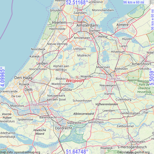
Weijpoort GPS coordinates[2]
52° 4' 54.012" North, 4° 48' 10.008" East
| Map corner | latitude | longitude |
|---|---|---|
| Upper-left | 52.51168°, | 4.09965° |
| Center: | 52.08167°, | 4.80278° |
| Lower-right: | 51.64748°, | 5.5059° |
| Map W x H: | 96.1×96.1 km | = 59.7×59.7mi |
| max Lat: | 53.48025° ⇑46.3% North |
| Weijpoort: | 52.08167° |
| min Lat: | ⇓53.7% South 50.76917° |
| min Long | Weijpoort | max Long |
| 3.38611° | 4.80278° | 7.16528° |
| W 20.4%⇐ | ⇒79.6% E |
Elevation
Elevation of Weijpoort is -1 m = -3 ft, and this is 16 m = 52 ft below average elevation for this country.
| Max E: |
203 m = 666 ft | 96.1% |
| Avg. | 15 m = 49 ft | |
| Weijpoort | -1 m = -3 ft | |
Min E: |
-6 m = -20 ft | 3.9% |
See also: Netherlands elevation on elevation.city.
Geographical zone
Weijpoort is located in North temperate zone (between Tropic of Cancer and the Arctic Circle). Distance of this North polar circle is 1610.2 km =1000.5 mi to North.| Distance of | km | miles | from Weijpoort |
|---|---|---|---|
| North Pole | 4216.1 | 2619.8 | to North |
| Arctic Circle | 1610.2 | 1000.5 | to North |
| Tropic Cancer | 3185 | 1979.1 | to South |
| Equator | 5790.9 | 3598.3 | to South |


Nearby cities:
15 places around Weijpoort: (largest is in red/bold)
• Bloemendaal
9.5 km =5.9 mi,  231°
231°
• Bodegraven
3.6 km =2.2 mi,  271°
271°
• Driebruggen
4.2 km =2.6 mi,  182°
182°
• Gouda
9.7 km =6 mi,  221°
221°
• Haastrecht
9.2 km =5.7 mi,  191°
191°
• Linschoten
8 km =5 mi,  105°
105°
• Nieuwkoop
7.9 km =4.9 mi,  346°
346°
• Oudewater
7.7 km =4.8 mi,  144°
144°
• Reeuwijk
6.6 km =4.1 mi, 233°
• Snelrewaard
9.4 km =5.8 mi,  129°
129°
• Stein
8.8 km =5.5 mi, 189°
• Waarder
2.6 km =1.6 mi,  151°
151°
• Woerden
5.5 km =3.4 mi,  86°
86°
• Woerdense Verlaat
9.2 km =5.7 mi,  27°
27°
• Zuidzijde
2.1 km =1.3 mi,  264°
264°
Sources, notices
• [Note1] Compared only with cities in Netherlands existing in our database
• [Src1] Map data: © OpenStreetMap contributors (CC-BY-SA)
• [Src2] Other city data from geonames.org with taken over terms of usage.
• [Src3] Geographical zone / Annual Mean Temperature by Robert A. Rohde @ Wikipedia
